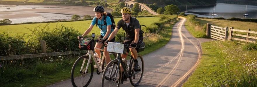
The pursuit of tranquil cycling experiences has become increasingly challenging as urban sprawl and traffic congestion continue to encroach upon traditional quiet routes. Yet, hidden across the British landscape lies an extensive network of peaceful pathways, disused railway lines, and heritage trails that offer cyclists the opportunity to explore stunning countryside whilst avoiding the stress and danger of busy motor traffic. These carefully preserved routes not only provide safe passage for cyclists of all abilities but also reveal the rich historical tapestry of Britain’s industrial and rural heritage.
Modern cycling enthusiasts face unique challenges when seeking authentic outdoor experiences away from vehicular chaos. The art of discovering these peaceful corridors requires sophisticated planning techniques, specialised equipment knowledge, and an understanding of legal access rights across diverse terrains. Successful navigation of remote cycling routes demands careful consideration of seasonal variations, wildlife patterns, and emergency preparedness protocols that ensure both safety and environmental responsibility.
Essential route planning techniques for Traffic-Free cycling adventures
Effective route planning for scenic cycling adventures requires a multi-layered approach that combines traditional cartography with modern digital tools. The foundation of successful quiet route discovery lies in understanding how to interpret various mapping systems and integrate real-time data from cycling communities. Professional route planners typically begin their research months in advance, systematically analysing potential pathways through cross-referencing multiple data sources to identify the most rewarding and safest options available.
Ordnance survey explorer maps for Off-Road navigation
Ordnance Survey Explorer maps remain the gold standard for detailed terrain analysis, providing cyclists with crucial information about elevation changes, surface types, and legal access rights. These comprehensive maps display bridleways as green dashed lines and byways as green diamonds, enabling cyclists to distinguish between different categories of permitted routes. The 1:25,000 scale offers sufficient detail to identify potential obstacles such as gates, stiles, or seasonal flooding zones that could impact journey planning. Expert cyclists often recommend studying contour lines carefully, as gentle gradients indicated by widely spaced contours typically provide more enjoyable cycling experiences than steep climbs marked by tightly packed elevation markers.
Sustrans national cycle network quiet route integration
The Sustrans National Cycle Network represents Britain’s most extensive collection of traffic-free and quiet road cycling routes, covering over 16,000 miles of carefully selected pathways. These numbered routes prioritise cyclist safety through strategic selection of disused railway lines, canal towpaths, and minor country roads with minimal motor vehicle usage. Route quality varies significantly across different regions, with some sections offering smooth tarmac surfaces whilst others present challenging gravel or dirt tracks requiring appropriate bicycle specifications. Regular maintenance schedules ensure most Sustrans routes remain accessible year-round, though seasonal variations can affect surface conditions and vegetation management.
Komoot and strava heatmap analysis for crowd avoidance
Digital platforms like Komoot and Strava provide valuable crowd-sourced data through heatmap visualisations that reveal popular cycling corridors and lesser-known alternatives. These tools enable cyclists to identify peak usage periods and discover quieter parallel routes that offer similar scenic value without the congestion. Strava’s segment data particularly excels at highlighting challenging climbs and scenic viewpoints that have garnered positive feedback from the cycling community. However, cyclists should exercise caution when interpreting heatmap data, as popular routes may indicate either excellent quality or simply convenient accessibility rather than optimal cycling conditions.
Bridleway and byway legal access classifications
Understanding legal access rights across different pathway classifications prevents conflicts with landowners and ensures responsible countryside usage. Bridleways permit cycling alongside horse riding and walking, though cyclists must yield priority to other users and exercise appropriate speed control in shared environments. Byways open to all traffic (BOATs) allow cycling but may also accommodate motor vehicles, requiring increased vigilance and defensive cycling techniques. Private tracks and footpaths strictly prohibit cycling, and unauthorised usage can result in trespassing charges and damage to landowner relationships that affect future access negotiations for the broader cycling community.
Premium scenic cycling destinations away from motor traffic
Britain’s network of traffic-free cycling routes encompasses diverse landscapes ranging from coastal estuaries to mountain passes, each offering unique experiences for cyclists seeking peaceful adventures. These carefully curated destinations provide
ample opportunities to ride for hours without encountering fast-moving traffic, while still maintaining reasonable daily distances between accommodation, food stops, and public transport connections. The following routes illustrate how disused railways, canal corridors, and historic drove roads have been transformed into world-class cycleways that prioritise scenery and safety over speed.
Camel trail cornwall: disused railway conversion excellence
The Camel Trail in Cornwall is one of the UK’s most celebrated examples of a disused railway line reborn as a traffic-free cycling route. Stretching for approximately 18 miles between Padstow, Wadebridge, and Bodmin, the trail follows the Camel Estuary and the former North Cornwall Railway alignment, offering consistently gentle gradients ideal for family cycling and loaded touring bikes. The crushed stone and tarmac surfaces are suitable for hybrid bikes, gravel bikes, and even road bikes with slightly wider tyres, making this scenic route accessible to a broad range of cyclists who wish to avoid busy coastal roads.
Because the Camel Trail closely follows the water’s edge for long sections, riders enjoy expansive estuary views, salt marshes rich with birdlife, and tidal landscapes that change character throughout the day. In high season, the central sections between Padstow and Wadebridge can become quite busy with hire bikes and pedestrians, so experienced riders often plan early morning or shoulder-season trips to preserve that sense of peaceful exploration. You can also integrate quieter back lane loops inland, using Ordnance Survey Explorer mapping, to escape the crowds while still returning to the trail for easy navigation back to your base.
Tarka trail devon: estuary and woodland circuit navigation
The Tarka Trail in North Devon provides one of the longest continuous traffic-free cycle paths in the UK, with over 30 miles of route between Braunton and Meeth largely separated from motor traffic. Like the Camel Trail, the Tarka reuses former railway lines, but here the landscape is more varied, combining wide estuary vistas along the Taw and Torridge with tranquil wooded cuttings and rolling rural backdrops. This makes it an excellent choice if you are planning a multi-day cycling tour that balances easy navigation with the option of more adventurous loops on surrounding lanes and bridleways.
Route planning on the Tarka Trail typically involves choosing one of several logical bases such as Barnstaple, Bideford, or Great Torrington, then designing daily out-and-back rides that avoid main roads almost entirely. The relatively smooth surfaces are ideal for pannier-laden touring bikes and e-bikes, and numerous cafés and heritage railway sites along the way provide natural pause points. Because parts of the trail are shared with walkers, dog owners, and mobility scooters, it pays to adopt a considerate speed and use a bell or polite verbal warnings on blind corners, especially during school holidays.
Tissington trail peak district: limestone heritage route
The Tissington Trail in the Peak District offers a contrasting experience, combining the practicality of a converted railway with the drama of upland limestone scenery. Running for around 13 miles between Ashbourne and Parsley Hay, this traffic-free path sits on the former Buxton to Ashbourne railway line and connects seamlessly with the High Peak Trail, enabling longer itineraries that remain almost entirely off-road. Gradients are moderate by Peak District standards, but the elevated position of the trail delivers far-reaching views across dales and dry stone-walled fields, making it one of the most visually rewarding quiet cycling routes in England.
Surface quality varies from compacted limestone to tarmac, so slightly wider tyres (28 mm and above) improve comfort and stability, particularly in wet conditions. Access points at Tissington, Alsop, and other villages offer opportunities to link in quiet lanes, while still avoiding the busier A-roads that funnel traffic through the national park. If you enjoy combining cycling with heritage exploration, you can plan stops at historic estate villages, old station platforms, and former goods yards that have been repurposed as cafés or visitor centres, turning a simple ride into an immersive journey through industrial and rural history.
Lon las cymru wales: national route 8 highland passages
Lon Las Cymru (National Cycle Network Route 8) delivers a very different form of traffic-free cycling adventure, crossing the spine of Wales from Cardiff or Chepstow in the south to Holyhead in the north. While not entirely separated from motor traffic, large sections follow very quiet lanes, forestry tracks, and minor mountain roads where vehicle volumes are minimal compared with trunk routes. This long-distance route is best suited to experienced cyclists who are comfortable with sustained climbs, remote stretches, and changeable weather, but the reward is a sequence of highland passages and valley descents that feel far removed from conventional road riding.
Effective planning for Lon Las Cymru involves breaking the journey into manageable stages, taking into account daily elevation gain rather than just distance. Some sections, such as those through Snowdonia and the Cambrian Mountains, feature long climbs on single-track lanes where you may see more sheep than cars, making them ideal for riders determined to avoid busy roads. Because accommodation and resupply points can be widely spaced, you will benefit from plotting out cafés, shops, and campsites in advance using a combination of Sustrans mapping, OS Explorer sheets, and digital tools like Komoot or cycle-specific route planners.
Great glen way scotland: loch-to-loch alpine experience
The Great Glen Way, linking Fort William to Inverness, offers a uniquely Scottish blend of lochside riding, canal towpaths, and high-level forest tracks that feel almost alpine in character. While originally designed as a walking route, substantial sections are cycle-friendly, particularly those along the Caledonian Canal and forest roads maintained by Forestry and Land Scotland. Riders can choose between lower-level options that remain closer to the water and higher variants that deliver panoramic views across Loch Ness and the surrounding mountains, depending on bike setup and confidence on rougher surfaces.
Because the Great Glen Way interlinks with the broader Scottish cycle network and local quiet lanes, it can form the backbone of longer Highland tours that avoid the busiest trunk roads such as the A82. Gravel bikes and robust touring machines with low gearing are generally the most comfortable choices here, especially if you intend to include the higher forest sections with their occasional steep ramps and loose surfaces. You will be riding through some of the most sparsely populated parts of the UK, so careful attention to weather forecasts, daylight hours, and emergency planning is essential if you want to enjoy the landscape without unnecessary risk.
Advanced equipment selection for remote terrain cycling
Selecting appropriate equipment for remote, traffic-free cycling routes is akin to choosing the correct tools for a technical mountain expedition: the wrong decision may not stop the trip entirely, but it will certainly make it more difficult and less enjoyable. When your route deliberately avoids main roads, you often lose easy access to bike shops, public transport, and roadside assistance, so your bike and kit need to be both robust and versatile. We can think of this as building redundancy into your setup, so small mechanical issues remain inconveniences rather than trip-ending events.
Bike choice should be guided primarily by surface type and load rather than speed, with gravel bikes, adventure road bikes, and rigid or short-travel mountain bikes often proving the most suitable for mixed-terrain cycle touring. Tyres in the 32–45 mm range with puncture protection and a semi-slick or light tread pattern strike an effective balance between rolling efficiency on compacted trails and grip on wet grass, gravel, or hard-packed mud. Lower gearing than you might use on club road rides is highly advisable, particularly on routes like Lon Las Cymru or the Great Glen Way where gradients can be prolonged and luggage weight significant.
Beyond the bike itself, luggage systems designed for stability on rough surfaces are crucial. Traditional rear panniers remain an excellent option for disused railway trails and canal paths, but bikepacking-style soft bags often perform better on narrow bridleways and forest tracks where occasional pushing or lifting of the bike is required. Waterproofing should be considered non-negotiable, as British weather patterns can shift quickly even in summer; dry bags and roll-top closures help ensure that spare clothing, electronics, and food remain serviceable after hours of rain. A small but well-organised toolkit, including multi-tool, spare links, tyre boots, and a robust pump, rounds out your essential mechanical preparedness.
Seasonal weather pattern analysis for optimal route timing
Planning cycling adventures far from crowded roads also means understanding how seasonal weather patterns alter both safety and ride quality on quiet routes. While summer may seem the obvious choice, some disused railway paths and popular traffic-free trails become significantly busier during school holidays, diminishing the tranquillity you might be seeking. Conversely, early spring and late autumn can offer quieter conditions and crisper air, but also bring shorter daylight hours, increased rainfall, and a higher likelihood of surface water or debris on off-road sections, especially in wooded cuttings and under tree canopies.
Studying regional climate data and long-range forecasts allows you to match route choice to likely conditions in a similar way that sailors match passages to prevailing winds. Coastal trails like the Camel and Tarka benefit from sea breezes and milder winter temperatures, but they can also be exposed to strong crosswinds that make lightly loaded bikes feel unstable. Highland and upland routes, including the Tissington Trail, Lon Las Cymru, and the Great Glen Way, are more sensitive to temperature drops and sudden weather fronts, which can transform a pleasant climb into a hazardous situation within an hour if you are underdressed or short of food.
In practical terms, this means building flexibility into your schedule and carrying layers appropriate for at least one season colder than the forecast suggests, particularly when riding in Wales or Scotland. Waterproof shells, insulated gilets, and lightweight gloves are small additions that dramatically increase comfort when rain or wind arrives unexpectedly on a remote moorland section. You might also plan rest days or shorter mileage days in regions prone to heavy rainfall, giving yourself the option to pause in a town or campsite rather than pushing on through unsafe conditions on slippery, leaf-covered paths or wind-exposed ridges.
Wildlife observation protocols during quiet route cycling
One of the great privileges of cycling on quiet, traffic-free routes is the opportunity to observe wildlife at close quarters, from wading birds on estuaries to deer in upland forests and otters along canalised rivers. Yet with this privilege comes responsibility: our presence should not cause undue stress or behavioural changes in the species we encounter. Think of yourself as a temporary guest in an open-air observatory, where low noise levels, predictable movements, and respectful distances allow natural patterns to continue largely undisturbed.
Simple behavioural adjustments can make a significant difference. Reducing speed when passing through known nesting sites, reed beds, or grazing areas gives animals more time to move away calmly and reduces the risk of sudden collisions. Using a bell or soft vocal cues can alert dog walkers and other users without startling wildlife in the same way that sudden braking or loud shouting might. If you stop to watch birds or mammals, keeping your bike between you and the animal and avoiding direct eye contact often helps them feel less threatened, increasing the chances of witnessing natural behaviours rather than flight responses.
From an ethical standpoint, feeding wildlife or deliberately approaching nests, dens, or roosts should be strictly avoided, even if it seems harmless or offers a better photograph. Not only can this alter natural foraging patterns and increase disease transmission, but in some protected areas it may also breach local bylaws or conservation regulations. Many national parks and nature reserves publish seasonal guidance on sensitive species and habitats; incorporating this information into your route planning ensures that your search for traffic-free cycling does not inadvertently compromise the very ecosystems that make these journeys so rewarding.
Emergency preparedness strategies for isolated cycling routes
When you deliberately choose cycling routes far from crowded roads, you are also choosing environments where help may be slower to reach you in the event of an incident. This does not mean that such adventures are inherently unsafe, but rather that you need to think more like a hillwalker or long-distance backpacker when it comes to risk management. A small investment in planning and lightweight safety equipment can transform a potential emergency into a manageable inconvenience, especially in areas with limited mobile phone coverage.
At a minimum, you should carry a compact first-aid kit tailored to cycling-specific issues such as cuts, abrasions, and minor joint sprains, alongside any personal medication you require. A paper map and compass, even if you primarily navigate via GPS, provide essential redundancy should batteries fail or devices malfunction in wet conditions. Informing a trusted contact of your intended route and expected return time, sometimes called leaving a “route card”, adds an additional layer of security; if you do not check in as planned, they have the information needed to raise the alarm with accurate details of your likely location.
Communication tools deserve particular attention. In remoter parts of Scotland or Wales, mobile signal can be intermittent or absent, so offline mapping and pre-downloaded routes are essential, and some riders may consider carrying a satellite messenger or personal locator beacon on more committing trips. Clothing also forms part of your emergency strategy: a lightweight survival bag or emergency bivvy, combined with an extra warm layer, can make a prolonged wait for assistance in cold, wet conditions significantly less dangerous. By approaching quiet route cycling with the same structured preparedness that mountaineers bring to remote summits, you maximise both your safety and your freedom to explore Britain’s most tranquil landscapes by bike.


