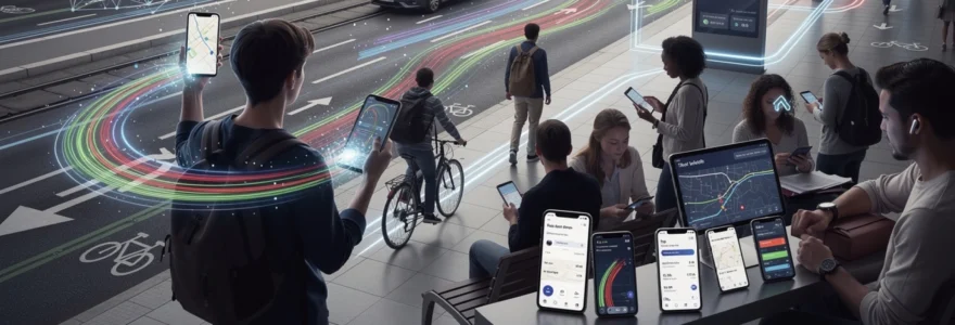
Modern transportation has undergone a profound transformation, driven by technological innovations that have revolutionised how we plan, navigate, and experience travel. Today’s travellers benefit from sophisticated algorithms, real-time data processing, and intelligent systems that work seamlessly behind the scenes to optimise every journey. The complexity of modern transport networks, once a barrier to efficient travel, has become manageable through advanced technological solutions that adapt to changing conditions and user preferences.
From artificial intelligence that predicts traffic patterns to mobile applications that integrate multiple transport modes, technology has eliminated much of the guesswork from route planning. The convergence of big data, machine learning, and ubiquitous connectivity has created an ecosystem where travellers can make informed decisions based on real-time information rather than static schedules or outdated maps.
Ai-powered route optimisation algorithms in contemporary travel planning
Artificial intelligence has fundamentally transformed route optimisation, moving beyond simple distance calculations to consider multiple variables that affect travel efficiency. Modern AI systems analyse historical data patterns, current traffic conditions, weather forecasts, and even special events to generate optimal route suggestions. These sophisticated algorithms process millions of data points simultaneously, creating personalised recommendations that adapt to individual travel preferences and constraints.
The evolution of AI in transportation reflects broader technological advancement trends, where machine learning models continuously improve through user interactions and feedback loops. Contemporary route optimisation systems can predict congestion before it occurs, suggest alternative paths proactively, and even recommend optimal departure times to minimise travel duration. This predictive capability represents a significant leap from reactive navigation systems that simply responded to current conditions.
Google maps machine learning infrastructure for Real-Time traffic analysis
Google Maps leverages vast amounts of anonymised location data from millions of devices to create comprehensive traffic analysis systems. The platform’s machine learning infrastructure processes this data through neural networks that identify traffic patterns, predict congestion, and calculate estimated travel times with remarkable accuracy. This system considers factors such as road capacity, historical traffic flows, and real-time incident reports to generate dynamic route recommendations.
The sophistication of Google’s approach extends to understanding seasonal traffic variations, event-based congestion, and even the impact of weather conditions on travel patterns. Machine learning algorithms continuously refine their predictions by comparing actual travel times with initial estimates, creating a feedback loop that improves accuracy over time. This technological foundation enables Google Maps to provide reliable navigation guidance for billions of users worldwide.
Waze crowdsourced data integration with predictive analytics
Waze revolutionised navigation through its community-driven approach, combining crowdsourced reporting with predictive analytics to create highly accurate traffic information. The platform encourages users to report incidents, road hazards, and traffic conditions in real-time, creating a collaborative network that benefits all participants. This crowdsourced data feeds into predictive models that can anticipate traffic developments and suggest proactive route adjustments.
The integration of user-generated content with algorithmic processing demonstrates how social collaboration can enhance technological solutions. Predictive analytics within Waze analyse patterns in user reports, historical data, and external factors to forecast traffic conditions up to several hours in advance. This capability allows the system to recommend routes that avoid predicted congestion, even when current conditions appear favourable.
Apple maps neural network processing for Multi-Modal journey planning
Apple Maps employs advanced neural network processing to integrate multiple transportation modes into cohesive journey plans. The system considers walking, driving, public transport, and cycling options simultaneously, creating comprehensive travel solutions that optimise for time, convenience, or environmental impact. This multi-modal approach reflects modern travel patterns where users frequently combine different transportation methods within a single journey.
Neural network processing enables Apple Maps to understand complex relationships between different transport options and user preferences. The system can recognise when walking to a different station might reduce overall travel time or when cycling might be faster than driving during peak hours. Multi-modal integration represents the future of urban transportation, where seamless transitions between different modes become as important as optimising individual route segments.
HERE technologies location intelligence platform for enterprise travel solutions
HERE Technologies provides enterprise-focused location intelligence that goes beyond consumer navigation to address complex business travel requirements. The platform offers APIs and tools that enable companies to integrate sophisticated routing capabilities into their
operations, from fleet management to last‑mile delivery planning. Enterprise travel managers can define complex constraints – such as vehicle capacity, time windows, toll costs, or low‑emission zones – and allow the routing engine to generate optimised itineraries at scale. Location intelligence solutions from HERE also power in‑vehicle navigation, enabling consistent guidance across mobile apps, dashboards, and logistics platforms, which is crucial for organisations coordinating thousands of daily journeys.
For businesses, this type of enterprise‑grade travel technology simplifies modern travel routes by turning fragmented data into actionable insights. Companies can monitor driver performance, adjust routes in response to disruptions, and provide accurate ETAs to customers in real time. As urban environments become more regulated and congested, platforms like HERE help organisations remain compliant, reduce fuel consumption, and maintain high service levels without adding complexity for travellers or drivers.
Mobile application ecosystems transforming route discovery and navigation
The rise of mobile ecosystems has changed how we discover, compare, and follow travel routes, especially in dense urban areas. Instead of juggling paper timetables, separate taxi numbers, and static maps, travellers now rely on integrated travel apps that aggregate multiple transport options into a single interface. These applications use real‑time data feeds, predictive algorithms, and intuitive design to simplify decision‑making and reduce uncertainty.
Mobile travel technology is no longer limited to basic turn‑by‑turn navigation. Today’s apps can calculate door‑to‑door journey times, factor in delays, and even recommend when to leave home to catch a specific connection. By combining route planning, ticketing, and live updates, they transform smartphones into comprehensive travel assistants that support every stage of the journey. This integrated approach is particularly valuable in complex metropolitan networks such as London, Manchester, or other major European cities.
Citymapper’s multimodal transport integration across london and manchester
Citymapper has become synonymous with multimodal route planning in large cities, offering detailed integration across buses, trains, trams, cycling schemes, and walking routes. In London and Manchester, the app draws on open transport data, live arrival information, and historical travel patterns to build highly accurate route suggestions. It will often show several alternatives side by side, allowing you to compare a pure public transport route with a mixed walking and tube option or a ride‑hail connection.
One of Citymapper’s strengths is its focus on real‑world usability. The app clarifies platform numbers, station exits, and walking times between interchanges, which can significantly reduce stress in unfamiliar stations. It also includes accessibility information, such as step‑free routes, helping travellers with mobility needs to choose suitable options. By surfacing these details in a clear, conversational interface, Citymapper turns complex urban networks into intelligible, personalised travel experiences.
Moovit’s public transit APIs and real-time service disruption management
Moovit approaches travel route simplification through a combination of consumer apps and powerful public transit APIs for third‑party developers. Its platform ingests real‑time data from transport authorities, vehicle GPS feeds, and user reports to identify service disruptions as they occur. When a bus is delayed, a metro line is closed, or a tram route is diverted, Moovit quickly updates journey suggestions and pushes notifications to affected users.
These capabilities are increasingly embedded in other mobility services via Moovit’s APIs. Ride‑hailing apps, city dashboards, and corporate mobility platforms can all tap into this rich transit dataset to improve their own route planning. For the end traveller, the benefit is simple: instead of arriving at a station only to discover a closure, they are alerted in advance and offered alternative options. In this way, Moovit’s real‑time disruption management helps maintain route reliability, even when networks are under strain.
Rome2rio’s global route comparison engine for long-distance travel
While many apps specialise in local navigation, Rome2Rio focuses on long‑distance travel routes across countries and continents. Its engine maps connections between flights, trains, coaches, ferries, and driving routes, giving users a high‑level overview of how to get from almost any point A to any point B in the world. This is particularly useful at the early planning stage, when you might be asking: “Is it faster to fly, take the train, or combine both?”
Rome2Rio’s interface presents estimated travel times, indicative prices, and typical operators for each segment, helping travellers weigh cost, speed, and convenience. By collapsing thousands of potential combinations into a small set of understandable options, the platform streamlines what would otherwise be hours of manual research. Long‑tail queries like “how to travel from a small town to a remote island” become solvable in a few clicks, illustrating how global route comparison tools are simplifying modern travel planning at scale.
Trainline’s dynamic pricing integration with rail network operators
Trainline combines route planning with ticketing, integrating directly with rail network operators across the UK and parts of Europe. One of its key strengths lies in dynamic pricing and fare discovery. Behind the scenes, Trainline’s algorithms scan different fare classes, advance purchase discounts, and split‑ticket opportunities to present cost‑effective options that travellers might not uncover on their own. For many users, this turns a traditionally opaque pricing system into a transparent, optimised experience.
The app also simplifies complex rail journeys that involve multiple operators or transfers. It bundles tickets into a single booking, provides live platform and delay information, and offers digital tickets that can be stored on a phone or smartwatch. By aligning routing logic with real‑time pricing and availability, Trainline reduces both financial and cognitive load for travellers, making rail an increasingly attractive alternative to car or air travel for medium‑distance routes.
Iot sensor networks and smart infrastructure integration
The Internet of Things (IoT) underpins a new generation of smart transport infrastructure that continuously senses, analyses, and responds to travel conditions. Roadside sensors, connected traffic lights, smart parking meters, and GPS‑equipped vehicles all generate a constant stream of data about how people and goods move through cities. When this information is aggregated and analysed, it provides a highly granular picture of network performance that traditional surveys could never match.
For travellers, the impact of IoT may not always be visible, but it is felt in shorter journey times and more reliable routes. Smart traffic management systems can adjust signal timings to ease congestion, connected buses can send accurate arrival predictions, and parking apps can direct drivers straight to available spaces instead of circling for minutes. In effect, IoT turns the transport network into a responsive organism, capable of self‑optimising in near real time.
Airports and railway stations are also embracing IoT to simplify complex passenger flows. Beacons and sensors monitor crowd densities, prompting staff to open additional security lanes or redirect passengers before bottlenecks form. Baggage handling systems use RFID tags and scanners to track luggage location, reducing the risk of loss and providing live updates to travellers’ phones. As more infrastructure assets become connected, we can expect route planning tools to incorporate this data directly, proposing paths that minimise not just distance but also queuing time and stress.
Dynamic pricing algorithms and demand-responsive transportation systems
Dynamic pricing algorithms and demand‑responsive transport systems are reshaping how routes are allocated and how much different journeys cost. In ride‑hailing services and some rail and air markets, prices fluctuate based on supply, demand, and predicted congestion. While surge pricing can be controversial, it also serves as a signal that nudges demand away from peak periods and saturated routes, thereby smoothing overall network usage.
On the operations side, demand‑responsive transport (DRT) services use algorithms to design routes on the fly based on passenger requests. Instead of fixed timetables and rigid lines, minibuses or shuttles adapt their paths dynamically, picking up and dropping off users within defined zones. This model, often coordinated through mobile apps, can provide flexible, lower‑cost alternatives in low‑density areas where traditional bus routes would be uneconomic. For travellers, it feels a little like combining a taxi with public transport – you share the vehicle but benefit from route optimisation at algorithmic speed.
These systems rely on rich, real‑time datasets: current bookings, historical demand patterns, traffic conditions, and operating constraints such as driver hours. Sophisticated optimisation engines then balance competing objectives, from minimising detours to keeping waiting times within acceptable thresholds. When implemented well, dynamic pricing and DRT can make modern travel routes more efficient, reduce empty vehicle miles, and expand mobility options for communities that have long been underserved by conventional networks.
Augmented reality navigation systems and geospatial technology applications
Augmented reality (AR) and advanced geospatial technologies are beginning to change how we perceive and follow travel routes, overlaying digital guidance directly onto the physical world. Instead of interpreting flat maps and mentally translating them into real‑world movements, travellers can now see arrows, labels, and directions appear on top of streets and buildings through their smartphone camera or wearable devices. This shift from abstract maps to “live” navigation reduces cognitive effort and can be particularly valuable in complex or unfamiliar environments.
Geospatial analytics underpins these AR experiences, combining precise location data, 3D models of urban spaces, and sensor inputs from devices. In practice, this means navigation systems can not only show you the shortest path but also highlight accessible entrances, busy intersections, or points of interest tailored to your preferences. As AR hardware becomes lighter and more mainstream, we are likely to see these technologies expand from experimental features to everyday tools that simplify wayfinding for millions of travellers.
AR walking directions through google live view technology
Google’s Live View feature is one of the most visible examples of AR in mainstream travel navigation. Using a combination of GPS, Street View imagery, and on‑device sensors, Live View positions digital arrows and street names in the camera view as you walk. This helps address a common challenge with urban walking directions: working out which way to start when surrounded by tall buildings and similar‑looking streets.
By anchoring instructions to real‑world landmarks, Live View makes it easier to follow subtle turns or navigate complex junctions. This can be particularly useful when emerging from underground stations or navigating dense city centres abroad, where street layouts may feel unfamiliar. For many users, the experience is like having an invisible local guide drawing your path on the street in front of you, turning potentially stressful first‑mile and last‑mile segments into straightforward, confident walks.
Indoor positioning systems using bluetooth beacons and Wi-Fi triangulation
Outdoor navigation is now routine, but what about complex indoor spaces such as airports, shopping centres, or multi‑level stations? GPS signals often weaken or disappear indoors, which is where indoor positioning systems (IPS) come into play. By using Bluetooth beacons, Wi‑Fi triangulation, and sometimes inertial sensors within smartphones, IPS can estimate a traveller’s location inside buildings with surprising accuracy.
Once location is established, indoor maps and route guidance can help passengers move between check‑in desks, security, gates, and amenities with ease. You might, for example, receive a notification that your gate has changed along with a highlighted path showing exactly how to get there from your current position. For operators, IPS data can reveal congestion hotspots and inform layout changes, staffing decisions, or targeted signage upgrades. In essence, indoor positioning extends the promise of digital navigation to some of the most confusing parts of the travel journey.
Mixed reality wayfinding in complex transport hubs like heathrow terminal 5
Mixed reality (MR) takes AR a step further by blending virtual objects with the physical environment in a more persistent and interactive way. In large, intricate hubs like Heathrow Terminal 5, MR pilots have explored how holographic signage or virtual assistants could guide passengers through security, connections, and boarding gates. Using head‑mounted displays or advanced mobile interfaces, travellers would see digital cues that feel anchored in real space – for example, a floating line leading them to their next checkpoint.
These MR wayfinding concepts are still emerging, but they illustrate how future travel routes could be simplified through more intuitive, spatially aware guidance. Imagine connecting flights in an unfamiliar airport without constantly checking screens, or accessing multilingual instructions that appear directly in your field of view. While challenges remain around hardware adoption, privacy, and accessibility, MR offers a glimpse of how geospatial technology might make even the most complex hubs feel manageable and human‑centred.
Blockchain technology and decentralised travel route verification
Blockchain technology introduces the possibility of decentralised, tamper‑resistant records for travel‑related data, including route verification and ticketing. In traditional systems, booking details, loyalty points, and travel permissions are held in siloed databases controlled by individual providers. This can create friction when journeys span multiple airlines, rail operators, or mobility services, as each system must trust and reconcile information from the others.
By contrast, a blockchain‑based ledger can store cryptographically secured records of bookings, route segments, and entitlements that multiple parties can read and verify. Smart contracts – self‑executing code stored on the blockchain – could automatically validate whether a traveller is eligible to board a particular leg, trigger compensation when delays exceed a threshold, or release payments once a service has been delivered. For travellers, this would mean fewer paper documents, less need to repeat the same information, and more transparent handling of disruptions or refunds.
Decentralised route verification could also play a role in emerging mobility‑as‑a‑service (MaaS) platforms, where a single subscription or pass covers buses, trains, bike‑sharing, and car‑sharing across providers. A shared, trusted ledger would help coordinate access rights and usage records without forcing all stakeholders into a single proprietary system. While blockchain in travel is still at an experimental stage, its potential to streamline complex, multi‑operator routes and enhance data integrity makes it an important technology to watch as modern travel continues to evolve.


