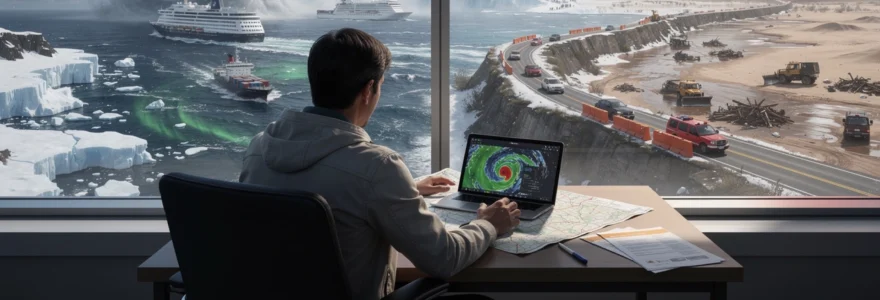
Weather doesn’t simply inconvenience travellers—it fundamentally reshapes journeys, forcing pilots, ship captains, expedition leaders, and road trippers to abandon carefully planned routes and navigate uncharted alternatives. From commercial aviation diversions avoiding hurricane systems to Antarctic cruise ships rerouting around Southern Ocean tempests, meteorological phenomena exert an uncompromising influence over global mobility. The intersection between atmospheric science and travel logistics has never been more critical, as climate change intensifies weather extremes and pushes traditional seasonal patterns into unpredictable territory. Understanding how different weather systems force route alterations isn’t merely academic—it’s essential knowledge for anyone who ventures beyond their doorstep, whether crossing oceans at 35,000 feet or navigating desert highways.
Meteorological phenomena that force route alterations in aviation and maritime travel
The aviation and maritime industries operate within an intricate web of atmospheric conditions that can transform routine journeys into complex navigational challenges. Every commercial flight and ocean voyage involves constant weather monitoring, with meteorologists and route planners working in tandem to identify potential hazards before they become critical threats. The Coriolis effect, which describes the deflection of moving objects caused by Earth’s rotation, plays a fundamental role in how weather systems develop and migrate across the globe, particularly affecting mid-latitude regions where most international travel occurs.
Cyclone systems and flight path diversions: case studies from hurricane katrina and typhoon haiyan
When Hurricane Katrina formed in the Atlantic in August 2005, airlines serving the Gulf Coast region implemented unprecedented diversions, cancelling over 2,800 flights and rerouting hundreds more through alternative corridors. The cyclonic system, with its counterclockwise rotation and sustained winds exceeding 175 mph, created a no-fly zone spanning approximately 400 miles in diameter. Commercial aircraft diverted to cities as distant as Dallas and Atlanta, adding between 300 and 600 nautical miles to journey lengths. The low-pressure system’s intensity forced pilots to navigate around towering cumulonimbus clouds that extended well above standard cruising altitudes.
Similarly, Typhoon Haiyan in 2013 demonstrated how tropical cyclones force maritime rerouting on a massive scale. Container ships traversing the Western Pacific added an average of 850 nautical miles to their voyages, circumnavigating the storm’s projected path by sailing southward through Indonesian straits before resuming northwesterly headings. The economic impact was substantial—fuel costs increased by 18-25% per affected voyage, and delivery schedules were pushed back by 4-7 days. These cyclonic events emerge from warm ocean waters exceeding 26.5°C, where rising air creates the initial low-pressure disturbance that, combined with low wind shear and the Coriolis effect, develops into rotating storm systems.
Jet stream volatility and transatlantic crossing adjustments
The polar and subtropical jet streams—those fast-moving ribbons of air flowing west to east across the Northern Hemisphere—can accelerate or decelerate transatlantic flights by up to 90 minutes. During winter months, when the polar jet stream strengthens and migrates southward, aircraft travelling from North America to Europe can encounter tailwinds exceeding 200 knots. Conversely, westbound flights face significant headwinds, forcing pilots to request higher or lower altitudes to escape the strongest currents. Airlines continuously monitor jet stream forecasts provided by agencies like NOAA, adjusting departure times and flight levels to optimise fuel efficiency.
In January 2024, a British Airways flight from New York to London completed the journey in just 4 hours and 56 minutes, benefiting from a jet stream clocking in at 265 knots. However, this atmospheric river of fast-moving air doesn’t simply accelerate journeys—it also creates clear air turbulence zones where wind shear becomes hazardous. Pilots routinely deviate 50-150 nautical miles north or south of planned routes to avoid these turbulent pockets, particularly where the jet stream interacts with mountain wave activity over Greenland and Iceland. The temperature contrasts between air masses at these boundaries generate unstable atmospheric conditions that can persist for hundreds of miles.
<hh3>Volcanic ash clouds: the 2010 eyjafjallajökull eruption’s impact on european air corridors
Volcanic ash behaves very differently from ordinary weather phenomena, but for aviation it can be even more disruptive than a major storm system. When Iceland’s Eyjafjallajökull volcano erupted in April 2010, fine ash particles were blasted into the upper troposphere and lower stratosphere, spreading across key European air corridors used by transatlantic and intra‑European flights. Unlike rain or snow, volcanic ash does not simply fall out of the sky in a predictable pattern; it can be transported hundreds or thousands of kilometres by prevailing winds and jet streams, forming diffuse but dangerous plumes.
Why is this such a problem for aircraft? Jet engines ingesting volcanic ash can suffer abrasion of turbine blades, blocked cooling channels and even flame‑outs as molten ash fuses inside the engine. Because there is no safe “minimum dose” of ash, airspace regulators adopted a zero‑tolerance approach in 2010, leading to the largest airspace shutdown since World War II. Over six days, more than 100,000 flights were cancelled across Europe, stranding an estimated 10 million passengers and costing airlines over US$1.7 billion in lost revenue and logistical expenses.
Route alterations during the Eyjafjallajökull event were both tactical and strategic. Some long‑haul flights from North America to southern Europe diverted along more southerly tracks over Spain and the Mediterranean, while others were forced to land at alternative hubs with clearer skies, such as Madrid or Lisbon, before passengers continued overland. Airlines collaborated with volcanic ash advisory centres, which used satellite imagery, computer dispersion models and pilot reports to map safe corridors through or around the plume. The incident prompted the development of more nuanced “low‑ash” thresholds, but even with improved modelling, modern flight planning still treats dense volcanic ash in the same way it would a solid wall.
Monsoon season maritime rerouting through the indian ocean and bay of bengal
While aircraft can often climb above turbulent weather, ships must face the full force of the atmosphere–ocean interface. Nowhere is this more evident than in the Indian Ocean and Bay of Bengal during the Southwest and Northeast Monsoon seasons. From June to September, the Southwest Monsoon drives strong southwesterly winds, heavy rainfall and steep waves across shipping lanes linking the Middle East, East Africa and South Asia. In reverse, the Northeast Monsoon from December to February brings cooler, drier air but can still generate powerful storms and rough seas.
Bulk carriers, container ships and oil tankers routinely alter their routes by hundreds of nautical miles to avoid the most intense monsoon depressions and cyclonic systems. A vessel sailing from Oman to Chennai, for example, might opt for a more southerly track closer to the equator during peak monsoon, trading extra distance for calmer seas and reduced risk of cargo damage. These deviations can lengthen voyages by one to three days, but they also lower the chance of structural stress, container loss and crew injury from rogue waves and extreme pitching.
Monsoon‑driven rerouting is not just about safety; it is also about timing. Port authorities in Mumbai, Colombo, Chittagong and Yangon monitor seasonal forecasts to anticipate when swell heights will impede loading operations or barge transfers. Cruise operators in the region adjust itineraries months in advance, shifting departures earlier or later in the shoulder seasons to avoid the heaviest rain bands. For passengers, this can mean last‑minute port swaps or extended days at sea, but for ship captains, following the monsoon patterns is as non‑negotiable as obeying a red traffic light.
Expedition tourism weather contingencies in extreme environments
Adventure travel to the planet’s most remote regions is uniquely vulnerable to rapid weather changes. Unlike commercial aviation or large‑scale shipping, expedition tourism often operates at the very edge of human endurance and infrastructure—on high mountain slopes, in polar seas, or deep in deserts where there is no quick escape route. In these environments, a sudden blizzard, katabatic wind or sandstorm can turn a carefully planned itinerary into a scramble for survival. Responsible operators therefore build substantial weather contingencies into their schedules, accepting that a “flexible route” is not a luxury but a core safety requirement.
For travellers, this raises a key question: how much unpredictability are you truly comfortable with? If you are trekking to Everest Base Camp, crossing the Drake Passage, or camping in the Sahara, you must accept that your timeline—and sometimes even your final destination—may change with little notice. Expedition leaders rely on a combination of satellite forecasts, local knowledge and real‑time observation to decide when to advance, when to retreat, and when to sit tight. In extreme environments, patience often becomes the most valuable piece of equipment you carry.
Everest base camp trek cancellations due to avalanche risk and whiteout conditions
The Everest region in Nepal is a textbook example of how mountain weather can override even the best‑laid trekking itineraries. The Khumbu Valley lies in the lee of some of the world’s highest peaks, where orographic lifting forces moist air upward, generating clouds, snowfall and sudden whiteout conditions. During pre‑monsoon (spring) and post‑monsoon (autumn) trekking seasons, storms can still develop rapidly, obscuring trails and increasing avalanche risk on steep slopes and hanging glaciers. Guides monitor recent snowfall, wind direction and temperature swings to assess whether slopes above the route are becoming unstable.
When avalanche risk crosses accepted thresholds, responsible trekking companies cancel or delay movements, even if it means missing flight connections or shortening the itinerary. In some years, as many as 10–20% of groups attempting the Everest Base Camp trek experience at least one significant weather‑related stoppage. Whiteout conditions, where visibility drops to just a few metres, can cause trekkers to lose the path or misjudge crevasses and steep drop‑offs. In such cases, guides will often halt progress at the nearest teahouse settlement, extending acclimatisation days or rearranging side trips until conditions improve.
For travellers, this is where mindset matters. If you view your trek as a rigid checklist of daily distances, you are likely to be frustrated by weather delays. But if you approach the journey as a high‑altitude expedition shaped by the Himalaya’s own timetable, last‑minute route changes make much more sense. Choosing operators with robust weather contingency plans, satellite communication devices and medically trained guides can make the difference between a safe delay and a dangerous push into deteriorating conditions.
Antarctic peninsula cruise itinerary modifications: drake passage storm systems
Reaching the Antarctic Peninsula almost always involves crossing the Drake Passage, a notorious stretch of ocean between Cape Horn and the Antarctic Circle where the Southern Ocean’s westerly winds circulate unimpeded around the globe. Here, low‑pressure systems spin eastward in rapid succession, generating waves that can tower 10–15 metres high. Expedition cruise ships study these storm systems days in advance, adjusting their departure windows from Ushuaia or Punta Arenas to avoid the worst of the “Drake Shake”. A well‑timed departure can mean the difference between a moderate crossing and an ordeal of rolling seas and widespread seasickness.
Once in Antarctic waters, weather continues to dictate the daily itinerary. Katabatic winds rushing down from the ice sheet can exceed 60 knots with little warning, making zodiac landings on exposed shorelines unsafe. Heavy sea ice can block planned channels, forcing ships to seek alternative bays or anchorages further north. Captains and expedition leaders hold nightly briefings, presenting one plan while often keeping two or three backups in mind, depending on how the latest satellite charts and barometric readings evolve overnight.
From a traveller’s perspective, Antarctic cruises are a perfect illustration of how weather can change the entire direction of a trip—literally and figuratively. You might set out expecting to visit a particular penguin colony or scientific station, only to find your ship turning toward a different fjord to avoid encroaching pack ice. Yet these unplanned diversions often lead to unexpected highlights: a calm, mirror‑smooth bay crowded with humpback whales, or a rarely visited research outpost accessible only under specific conditions.
Sahara desert safari sandstorm protocols and alternative route planning
In hot desert environments, visibility can vanish almost as quickly as in a blizzard—but instead of snowflakes, it is sand and dust that fill the air. The Sahara is infamous for haboobs and shamal winds that whip up towering sandstorms capable of grounding small aircraft, blocking desert tracks and infiltrating engine components. On overland safaris in Morocco, Algeria, Tunisia or Egypt, local guides watch for pressure drops, wind shifts and distant “walls” of dust on the horizon as tell‑tale signs that a storm is brewing. When one approaches, the immediate priority is to secure vehicles and seek shelter in established camps, fortified auberges or natural windbreaks such as rocky outcrops.
Because sandstorms can last several hours to multiple days, operators building desert itineraries often include flexible buffer days and multiple route options between key oases and towns. A planned off‑road traverse across open erg (dune fields) might be swapped for a more sheltered route along hamadas (rocky plateaus) or dry riverbeds that provide better traction and landmarks. Night driving is typically avoided in storm‑prone periods, as blowing sand reflecting headlights can be as disorienting as dense fog. Travellers with respiratory conditions are advised to carry masks or buffs and protective eyewear, much like skiers preparing for spindrift on a windy mountain ridge.
If you are considering a Sahara desert safari, ask your operator direct questions about their sandstorm protocols and alternative route planning. Do they have satellite phones or radio communication with base camps? How do they decide when to stop moving and when to resume? Their answers will tell you whether weather contingencies are an afterthought—or an integral part of their operational mindset.
Arctic circle expeditions: navigating polar vortex events and ice shelf instability
In the Arctic, extreme cold meets shifting sea ice, creating a dynamic environment where even experienced teams can be forced to alter course daily. Polar vortex events—large‑scale low‑pressure systems of frigid air encircling the poles—can occasionally meander southward, bringing sudden temperature plunges and intense wind chill to regions such as Svalbard, Greenland or northern Canada. For ski expeditions, dog‑sled journeys and icebreaker cruises operating near the Arctic Circle, these events can turn relatively manageable conditions into life‑threatening exposure, with effective temperatures dropping below –40°C.
Ice shelf and sea ice instability present an additional navigational challenge. Satellite imagery now shows that formerly reliable ice bridges and multi‑year ice fields are thinning or breaking up earlier in the season due to climate change. Guides planning over‑ice routes must be prepared to reroute around newly formed leads (cracks) and polynyas (areas of open water), sometimes adding days of detours to find safe crossing points. For ships, the changing ice distribution can close traditional channels while opening new ones, forcing bridge officers to adapt constantly in coordination with ice pilots and national ice services.
For travellers joining Arctic expeditions, this fluidity can be disorienting but also fascinating. You might see your planned landing at a historic hunting hut replaced by a zodiac cruise along a calving glacier front because ice conditions have changed overnight. It is much like navigating a city where roads appear and disappear every few days—you need a guide who not only knows yesterday’s map, but can also read the shifting “traffic” of wind, ice and temperature in real time.
Road trip weather-induced detours: infrastructure and safety considerations
Not every weather‑driven route change happens at 35,000 feet or in polar seas. For many of us, the most immediate impact comes when a storm, flood or wildfire forces a detour on a long‑planned road trip. Modern road networks are engineered with certain weather conditions in mind, but when extremes exceed those design thresholds, authorities have no choice but to close sections for safety. Rockfalls after heavy rain, washouts from flash floods, ice‑slicked mountain passes and smoke‑choked highways can all transform a scenic drive into an exercise in contingency planning.
Unlike aircraft and ships, which typically have professional route planners and meteorologists on call, road trippers often depend on public advisories, navigation apps and local news. This makes situational awareness critical. Before you set off, do you check seasonal climate patterns and recent storm histories for your chosen route, or do you rely purely on the forecast for the day of departure? Building flexibility into your schedule—an extra overnight stop, a secondary route, or even a backup destination—can dramatically reduce stress when weather forces a change of plans.
Flash flood closures on california’s pacific coast highway and interstate 70 through colorado
California’s Pacific Coast Highway (PCH) is world‑famous for its ocean views, but its location along steep coastal bluffs makes it highly vulnerable to heavy rain and landslides. During strong atmospheric river events—long, narrow corridors of concentrated moisture streaming in from the Pacific—intense rainfall can trigger debris flows that bury the roadway or undercut its foundations. In January 2021, for example, a burn scar from the Dolan Fire above Big Sur combined with torrential rain to wash out a section of Highway 1, closing a major stretch for months. Travellers were forced to reroute inland via Highway 101, adding several hours of driving to what is usually a leisurely coastal journey.
Far from the ocean, Interstate 70 through Colorado faces a different but equally disruptive threat: flash floods and mudslides in steep mountain canyons. Glenwood Canyon, a critical east–west corridor, has experienced repeated closures when intense thunderstorms unleash debris flows from burn scars left by wildfires. In 2021, multiple events shut the interstate for days at a time, forcing cross‑country travellers to take long detours north or south across the Rockies. For truckers and holiday‑makers alike, this demonstrates how a localised storm in a confined canyon can have continent‑scale impacts on travel times and logistics.
Practical strategies for road trippers include checking state department of transportation websites and social media feeds, enabling severe weather alerts on navigation apps, and understanding basic topography. If your route follows a narrow canyon or cliff‑hugging coastal road, it is inherently more susceptible to closure from landslides and flash floods. Having an inland alternative mapped out in advance can mean the difference between a swift pivot and a stressful scramble.
Blizzard conditions shutting down trans-canada highway sections
In winter, snowstorms across Canada can shut down hundreds of kilometres of the Trans‑Canada Highway, a vital link that stretches over 7,800 km from coast to coast. Blizzard conditions—defined by strong winds, blowing snow and severely reduced visibility—are particularly hazardous in open prairie sections of Saskatchewan and Manitoba, where there are few natural windbreaks. Whiteouts can reduce visibility to near zero, making lane markings and other vehicles effectively disappear. In such circumstances, police and highway authorities will close segments pre‑emptively to prevent multi‑vehicle pileups.
Mountain passes in British Columbia and Alberta present another set of challenges. Rapidly changing weather, heavy snowfall, and avalanche danger combine to create complex closure decisions. Highway crews use controlled avalanche releases, snow sheds and ploughing operations to keep roads open, but when forecast models indicate a high risk of natural avalanches, they may close passes entirely until conditions stabilise. For long‑haul drivers and winter road trippers, this can mean spending unplanned nights in small towns or truck stops while waiting for the all‑clear.
If you are planning a winter journey along the Trans‑Canada Highway, building extra days into your itinerary is not just a convenience—it is a safety measure. Equipping your vehicle with winter tyres, emergency supplies and full fuel tanks before entering remote stretches gives you more options if you encounter weather‑related delays. In effect, you are adopting the same mindset as an expedition team, accepting that nature will ultimately decide how fast you can move.
Wildfire smoke visibility restrictions: route 66 and australian outback alternatives
Wildfires are no longer confined to remote forests; increasingly, they threaten major road corridors and tourist routes. Along historic Route 66 in the American West, summer and autumn wildfire seasons have brought episodes of thick smoke that drastically reduce visibility and degrade air quality. Even when flames are kilometres away, smoke can settle into valleys and basins, prompting highway patrols to impose speed reductions or temporary closures. For travellers chasing “the open road” experience, this can translate into detours onto interstate highways far from the iconic roadside stops they had planned to visit.
In the Australian outback, bushfires and associated smoke present similar challenges but over far greater distances. Long stretches of highways like the Stuart or Eyre can be affected when shifting winds push smoke plumes across the roadway, cutting visibility and creating health risks, especially for those with asthma or other respiratory conditions. Authorities may implement rolling closures as fire fronts move, and roadhouses can become impromptu shelters for stranded motorists. For overlanders and campervan travellers, this underscores the importance of monitoring fire danger ratings and staying in regular contact with local information sources.
When planning routes through fire‑prone regions, it helps to think of smoke as another form of fog—one that can appear or thicken quickly as wind direction changes. Checking wildfire incident maps, carrying N95 masks and having alternative corridors pre‑planned can help you adapt if conditions deteriorate. Sometimes, the safest choice is to postpone a leg of your journey entirely, just as pilots delay take‑off when visibility drops below minimums.
Real-time weather forecasting technologies for dynamic journey planning
The good news for modern travellers is that we have more tools than ever before to anticipate and respond to weather‑driven disruptions. Where earlier generations relied on barometers and local lore, we now tap into global weather models, satellite constellations, Doppler radar networks and highly detailed mobile apps. In essence, you can carry a miniature meteorology lab in your pocket, helping you understand when a storm will cross your road, a jet stream will intensify over your flight path, or a gale will hit your sailing route.
Yet technology is only as useful as your willingness to consult it and act on its warnings. How often do we see travellers pressing ahead “because it’s on the itinerary,” even as forecasts clearly show deteriorating conditions? Integrating real‑time weather data into your journey planning does not mean obsessively checking apps every hour; rather, it means scheduling regular check‑ins at decision points—before take‑off, before a mountain pass, or before leaving harbour—and being willing to adjust course when the data suggests you should.
NOAA weather prediction models and aviation weather center integration
Behind every seemingly simple forecast lies a suite of sophisticated numerical models, and for aviation, the U.S. National Oceanic and Atmospheric Administration (NOAA) is a key player. Models such as the Global Forecast System (GFS) and High‑Resolution Rapid Refresh (HRRR) simulate atmospheric conditions at multiple levels, generating forecasts for wind, temperature, turbulence and convection. The Aviation Weather Center (AWC), part of NOAA, distils these outputs into products like Significant Weather (SIGWX) charts, turbulence forecasts and convective outlooks used by dispatchers and flight crews around the world.
Airlines integrate AWC data into their flight planning systems, allowing dispatchers to propose fuel‑efficient routes that also avoid hazardous weather. For example, if a line of strong thunderstorms is forecast along a typical jet route, planners may file an alternative track that arcs hundreds of miles around the convective zone. Pilots then monitor updated briefings via datalink during flight, adjusting altitude or route segments as new AWC advisories arrive. This constant feedback loop between model output and operational decision‑making is what enables large fleets to move millions of passengers safely through an ever‑changing atmosphere.
While commercial pilots have direct access to these specialised tools, general aviation pilots and even informed travellers can view many AWC products online. Understanding basic elements—like how jet streaks, frontal zones and turbulence forecasts appear on charts—can give you a deeper appreciation of why your flight path sometimes deviates from the straight line shown on a booking map.
Satellite imagery analysis using GOES-R series and meteosat systems
Satellites provide the “eyes in the sky” that make global, real‑time weather monitoring possible. In the Americas, the GOES‑R series of geostationary satellites delivers high‑resolution imagery every 5–10 minutes, capturing cloud development, storm evolution and atmospheric rivers as they unfold. Over Europe, Africa and parts of Asia, Meteosat satellites serve a similar role, with multiple spectral channels that reveal cloud top temperatures, moisture content and even volcanic ash. Meteorologists combine these images with model output to track rapidly changing systems such as tropical cyclones, mid‑latitude depressions and convective storms.
For aviation and maritime travel, satellite data is akin to a live traffic camera network for the sky and sea. Airlines use satellite‑derived winds and cloud fields to refine jet stream positions and turbulence forecasts, while ship captains monitor large‑scale cloud patterns to anticipate frontal passages and squall lines. In the case of volcanic eruptions like Eyjafjallajökull, specialised channels detect ash clouds that are invisible to the naked eye, enabling volcanic ash advisory centres to delineate no‑go zones with increasing precision.
Travellers do not need to become satellite experts, but learning to interpret basic infrared or visible imagery can be surprisingly accessible. Many weather websites and apps provide near‑real‑time satellite loops, letting you watch storm systems approach your region much like you would watch a rain radar. Seeing a line of thunderstorms or a spiralling low on satellite images can make the decision to delay a hike, drive or sail feel far more concrete.
Mobile applications: windy.com, aviation weather apps, and marine traffic weather overlays
Mobile apps have brought professional‑grade weather visualisation tools to everyday travellers. Platforms like Windy.com, for example, allow users to overlay global model data on interactive maps, showing wind speed, wave height, precipitation and cloud cover at multiple altitudes. Pilots can use dedicated aviation weather apps to access METARs, TAFs and NOTAMs, while sailors and yacht skippers often subscribe to specialised marine forecasting services integrated with chartplotters and AIS (Automatic Identification System) data. These tools turn your smartphone or tablet into a dynamic route‑planning assistant.
Consider how a road‑trip driver might use these apps: by checking hourly rain or snow projections along a planned route, they can choose whether to depart earlier, later or even take an entirely different highway. A paraglider pilot can examine wind shear and thermal indices before deciding whether conditions are safe. For long‑distance cyclists, overlaying wind forecasts on their route can help them schedule rest days to avoid riding into headwinds exceeding 30 km/h—a small but significant way that weather changes the direction and feel of the trip.
The key is not to let the sheer volume of data become overwhelming. Focus on a few variables most relevant to your mode of travel—wind and visibility for flying, swell and gusts for sailing, precipitation and temperature for driving or hiking. By checking these systematically at key decision points, you transform weather apps from novelty gadgets into genuinely powerful navigation aids.
Doppler radar systems for severe weather detection and route optimisation
Doppler radar adds another crucial dimension to modern weather awareness by revealing not only where precipitation is falling, but also how it is moving. Networks of ground‑based radars scan the atmosphere for raindrops, hailstones and even insects, using frequency shifts to infer wind velocity within storm cells. This allows meteorologists to identify rotating thunderstorms, downbursts and squall lines, issuing timely warnings for phenomena such as tornadoes and microbursts that pose extreme risks to aircraft on take‑off and landing.
Airports integrate radar data into their operations to manage runway use, arrival spacing and ground handling. If a strong thunderstorm with embedded wind shear is advancing toward a major hub, arrivals may be put into holding patterns or diverted to alternates, while departures are temporarily halted. This is one of the most visible ways weather can abruptly change the direction of a trip for passengers, as flights suddenly divert to cities they never expected to visit. For drivers, radar imagery on apps can help avoid the heaviest cells, rerouting around regions of intense rainfall that might cause hydroplaning or flash floods.
Think of Doppler radar as the equivalent of headlights piercing the dark interior of a storm. Where satellite imagery shows the overall cloud mass, radar reveals the internal structure and motion, giving forecasters and travellers alike a more detailed picture of where the real hazards lie. Combining radar snapshots with model forecasts enables not just reaction, but proactive route optimisation—choosing paths and timings that minimise exposure to the most dangerous weather.
Historical weather events that redirected famous voyages and expeditions
Weather has been shaping the fate of journeys for as long as humans have taken to the seas and skies. Before numerical models and satellites, sailors, explorers and early aviators depended on rudimentary instruments, personal experience and sometimes sheer luck to navigate storms, trade winds and fog. Many iconic voyages only became “famous” because weather forced unexpected detours, shipwrecks or discoveries. In that sense, weather has been a silent co‑author of history, redirecting not just individual trips but trade routes, migration patterns and geopolitical events.
Consider Christopher Columbus’s 1492 voyage. Rather than sailing into persistent headwinds, he exploited the North Atlantic’s prevailing easterly trade winds to reach the Caribbean, then returned to Europe via the westerlies further north. His discovery was as much a triumph of wind‑aware routing as it was of navigation by stars. Centuries later, the ill‑fated Franklin Expedition (1845) sought the Northwest Passage but became trapped in Arctic sea ice, with shifting pack ice and harsh winters dooming both ships and crew. Their failure underscored how inadequate understanding of polar ice and weather could turn ambitious exploration into tragedy.
In aviation history, Charles Lindbergh’s 1927 solo transatlantic flight in the Spirit of St. Louis required meticulous weather planning to exploit tailwinds and avoid storms, while World War II operations such as the D‑Day landings hinged on narrow windows of acceptable weather and tide conditions. More recently, around‑the‑world sailing races like the Vendée Globe or The Ocean Race have seen yachts detouring thousands of miles to avoid Southern Ocean storms or to stay within prescribed ice‑limit zones. In each case, weather systems—trade winds, jet streams, cyclones and ice fields—have acted as invisible “rails” guiding what humans could realistically attempt.
When we recognise these historical patterns, modern travel disruptions become easier to put into perspective. A diverted flight or rerouted cruise is part of a long continuum in which weather has always held the final veto over our plans. The difference today is that we have far better tools to see those changes coming and to adapt before we are caught off‑guard.
Travel insurance coverage and weather-related itinerary changes: policy analysis
Given how often weather can change the entire direction of a trip, from delayed flights to cancelled expeditions, it is no surprise that travel insurance has evolved to address meteorological risks. However, the fine print can be complex. Not all “bad weather” counts as a covered reason for trip cancellation or interruption; many policies require that the weather event cause a documented service disruption, such as a flight cancellation by the airline or an official evacuation order at your destination. Simply deciding not to travel because the forecast looks rainy or hot is rarely enough.
Comprehensive policies typically cover weather‑related issues when they result in specific, verifiable impacts: airport closures, mandatory evacuations, widespread power outages or accommodation becoming uninhabitable due to storm damage. Some also extend coverage to missed connections caused by earlier weather delays, reimbursing additional transport or hotel costs incurred while catching up with a tour or cruise. In the expedition sector, specialised policies may reimburse clients if operators cancel departures due to avalanche risk, high seas or ice conditions—scenarios where safety protocols rightly override commercial considerations.
For travellers, the challenge is matching coverage to the type of weather risk most relevant to their itinerary. Are you flying during peak hurricane season to a coastal destination? Driving across mountain passes in winter? Booking an Antarctic cruise or Everest trek where weather cancellations are common? Reading policy documents for terms like “weather,” “natural disaster,” “force majeure” and “operator cancellation” is essential. In some cases, a “cancel for any reason” (CFAR) upgrade offers the broadest flexibility, allowing you to abandon plans even if the trigger does not fit standard covered reasons, though this comes at a higher premium and often only reimburses a percentage of costs.
Ultimately, travel insurance should be seen as one layer in a multi‑tiered approach to weather resilience, alongside flexible itineraries, informed route planning and realistic expectations. By understanding how your policy responds to storms, floods, blizzards or heatwaves, you can make more confident decisions when forecasts start to shift. Weather may still change the direction of your trip—but with the right preparation, it does not have to derail it entirely.


