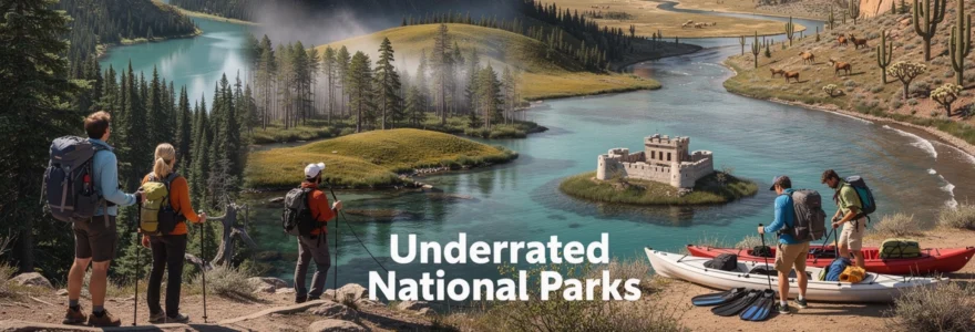
America’s 63 designated national parks attract millions of visitors annually, yet some of the most spectacular natural treasures remain relatively unknown to mainstream tourism. While iconic destinations like Yellowstone and the Grand Canyon command international attention, dozens of equally remarkable parks offer unparalleled wilderness experiences without the overwhelming crowds. These hidden gems showcase diverse ecosystems, from ancient bristlecone pine groves in Nevada’s remote mountains to underwater coral gardens in Florida’s pristine waters.
The disparity in visitor numbers tells a compelling story about undiscovered America. Great Smoky Mountains National Park welcomed over 13 million visitors in 2023, while some equally magnificent parks receive fewer than 100,000 annual visitors. This dramatic difference creates extraordinary opportunities for travellers seeking authentic wilderness encounters, pristine photography conditions, and genuine solitude in nature’s most stunning settings.
Hidden gems in america’s western wilderness: remote parks beyond yellowstone and yosemite
The American West harbours some of the continent’s most breathtaking landscapes, yet many remarkable national parks remain overshadowed by their famous neighbours. These lesser-known destinations offer exceptional geological diversity, from towering granite peaks to ancient volcanic formations, providing visitors with profound wilderness experiences typically reserved for the most remote corners of the planet.
Western national parks demonstrate remarkable geological complexity, spanning millions of years of Earth’s history. Many feature unique ecosystems adapted to extreme elevations, arid climates, and challenging terrain conditions that support endemic species found nowhere else on Earth.
Great basin national park nevada: lehman caves and ancient bristlecone pines
Great Basin National Park represents one of America’s most isolated and scientifically significant protected areas, situated along Nevada’s eastern border near the Utah state line. The park encompasses Wheeler Peak, Nevada’s second-highest summit at 13,065 feet, supporting alpine ecosystems rarely associated with the Silver State’s predominantly desert reputation.
The park’s crown jewel includes ancient bristlecone pine forests containing trees over 5,000 years old, making them among Earth’s oldest living organisms. These remarkable specimens grow in twisted, sculptural forms at elevations exceeding 11,000 feet, where harsh growing conditions create their distinctive gnarled appearance and exceptional longevity.
Lehman Caves system offers guided underground tours through spectacular limestone formations, including rare shield formations, flowstone cascades, and delicate cave pearls. The cave maintains a constant 50-degree temperature year-round, providing comfortable exploration conditions regardless of external weather patterns.
Great Basin’s remote location along the “Loneliest Road in America” contributes to some of the darkest night skies in the continental United States, earning Gold-tier certification from the International Dark-Sky Association.
North cascades national park washington: alpine lake districts and glacial formations
North Cascades National Park encompasses over 500,000 acres of pristine wilderness in Washington’s northern mountains, featuring more glaciers than any other continental US national park outside Alaska. The park’s rugged terrain supports over 300 glaciers and countless alpine lakes nestled within dramatic granite cirques carved by ancient ice flows.
The park’s unique structure divides into two separate units connected by Ross Lake National Recreation Area, creating diverse recreational opportunities from wilderness backpacking to scenic driving along the North Cascades Highway. Most visitors experience the park’s stunning scenery from State Route 20, yet few venture into the designated wilderness areas where solitude and pristine alpine conditions await.
Backcountry camping requires permits and advanced planning, yet rewards adventurous visitors with access to remote lakes, pristine meadows filled with wildflowers during summer months, and challenging mountaineering routes on peaks exceeding 8,000 feet elevation. The park’s extensive trail system connects to the larger Cascade mountain ecosystem, providing wildlife corridors for black bears, mountain goats, and numerous bird species.
Black canyon of the gunnison colorado: precambrian rock formations and vertical wall climbing
Black Canyon of the Gunnison showcases some of North America’s most dramatic vertical geology, where ancient Precambrian rocks create walls plunging over 2,
000 feet down to the Gunnison River. In some sections, sunlight barely reaches the canyon floor for more than 30 minutes a day, creating an otherworldly, shadow-filled environment that feels more like a subterranean world than an open-air gorge. The narrowness of the canyon is striking: at one point the rim overlooks are only about 1,100 feet apart, while the river below flows through a chasm just 40 feet wide.
Experienced climbers consider Black Canyon of the Gunnison one of the premier sites for multi-pitch, traditional climbing on near-vertical metamorphic rock. Routes on the famous Painted Wall, Colorado’s highest cliff at 2,250 feet, demand advanced technical skills, careful route-finding, and a high tolerance for exposure. Less technical visitors can still appreciate the canyon’s geology from rim overlooks along the South Rim Road or the quieter North Rim, where short trails offer big views without committing to strenuous descents.
Hiking into the inner canyon follows steep, unmaintained routes that require a free wilderness use permit. These descents can feel more like controlled scrambles than standard hikes, with loose rock, down-climbing sections, and no switchbacks to ease the grade. If you’re considering a trip into the canyon, treat it like a backcountry climb rather than a casual national park hike—proper footwear, plenty of water, and realistic turnaround times are essential.
Guadalupe mountains national park texas: permian reef fossil formations and desert highlands
Guadalupe Mountains National Park rises abruptly from the West Texas desert, preserving the most extensive exposed Permian reef complex in the world. Over 260 million years ago, this region formed part of a vast inland sea; today, the fossilized Capitan Reef towers above the Chihuahuan Desert in dramatic limestone escarpments. The park protects over 86,000 acres of rugged peaks, canyons, and high desert grasslands, including Guadalupe Peak, the highest point in Texas at 8,751 feet.
For geology enthusiasts, hiking here is like walking along the cross-section of an ancient ocean. Fossilized sponges, algae, and reef-building organisms appear in cliff faces and scattered rock fragments along the trails, providing tangible evidence of long-vanished marine ecosystems. The park’s signature hike, Guadalupe Peak Trail, rewards the strenuous 3,000-foot ascent with sweeping views across the desert and a sense of standing on the “roof of Texas.”
Despite its proximity to major highways, Guadalupe Mountains remains one of the least visited national parks in the Lower 48, often seeing under 200,000 visitors a year. Winds can be fierce and water is scarce, so you’ll need to carry all your drinking water on most hikes and watch weather forecasts closely. In return, you’ll gain access to quiet canyons, ponderosa pine forests at higher elevations, and night skies bright enough to rival more famous dark-sky destinations.
Underexplored eastern seaboard national parks: maritime ecosystems and coastal geology
While the American West often dominates conversations about national parks, the eastern seaboard hosts its own collection of underrated national parks shaped by ocean forces, tidal systems, and humid coastal climates. These protected areas highlight maritime ecosystems where rocky headlands, barrier reefs, mangrove forests, and flooded forests all play crucial roles in coastal resilience. If you tend to associate national parks with mountains and deserts, these Atlantic and Gulf Coast parks offer a refreshing contrast.
The East Coast’s national parks are particularly valuable for studying climate change and sea-level rise. From tidal pools along Maine’s rugged shoreline to subtropical coral reefs in Florida, these parks serve as living laboratories monitoring shifting ocean temperatures, storm patterns, and species migrations. For travelers, they provide immersive experiences in coastal geology, wildlife viewing, and water-based recreation that complement more traditional, land-focused national park trips.
Acadia national park maine: cadillac mountain summit and tidal pool ecosystems
Acadia National Park occupies much of Maine’s Mount Desert Island and several nearby islands, combining granite peaks, dense forests, and a wave-battered Atlantic coastline in a compact, easily explored area. Cadillac Mountain, rising 1,530 feet above sea level, is often cited as one of the first places in the continental United States to see sunrise during parts of the year. Driving or hiking to its summit rewards you with panoramic views across Frenchman Bay, offshore islands, and inland lakes carved by glacial activity.
Along the park’s rugged shoreline, tide pools form intricate microhabitats where barnacles, starfish, sea urchins, and anemones cling to rock ledges. Visiting during a low tide window turns sections of the coast into a natural classroom, allowing you to observe how marine organisms adapt to cyclical changes in water levels, temperature, and salinity. Just like reading tree rings to understand a forest’s history, carefully observing a single tide pool can teach you volumes about the health of the entire marine ecosystem.
Acadia does receive over 3 million visitors a year, but it still feels underrated compared to Western icons and remains overlooked by many international travelers planning U.S. national park itineraries. To escape peak-season congestion, consider visiting in late spring or early fall, using the Island Explorer shuttle system, and exploring less-trafficked areas such as the Schoodic Peninsula. With strategic timing, you can enjoy sunrise on Cadillac Mountain, cycle the historic carriage roads, and wander quiet coastal trails without feeling overwhelmed by crowds.
Congaree national park south carolina: old-growth bottomland hardwood forests
Congaree National Park, located just southeast of Columbia, South Carolina, protects the largest intact expanse of old-growth bottomland hardwood forest remaining in the United States. This floodplain ecosystem, shaped by periodic inundations from the Congaree River, supports towering loblolly pines, bald cypress, and hardwood giants that rival the height of some Western conifers. Many visitors are surprised to discover champion trees here that rank among the tallest of their species anywhere in the world.
The park’s elevated boardwalk loop offers an accessible introduction to this unique landscape, winding above seasonally flooded swamps dotted with cypress knees and tangled understory vegetation. In spring and early summer, synchronous fireflies create a dazzling nocturnal display, flashing in unison across sections of the forest for a brief window each year. If you’ve ever wanted to see a forest come alive with its own natural light show, this is one of the few places in North America where that experience is possible.
Because Congaree lacks the dramatic mountain vistas of more famous parks, it often flies under the radar for national park road trips. Yet its flat terrain makes it ideal for canoeing, kayaking, and low-impact hiking, especially during cooler months when mosquitoes are less intense. Water levels can change quickly, so before launching a boat or committing to longer trails, check current conditions and trail closures via the National Park Service for a safer, more enjoyable visit.
Dry tortugas national park florida: fort jefferson historic fortification and coral reef systems
Dry Tortugas National Park lies about 70 miles west of Key West in the Gulf of Mexico, accessible only by seaplane or boat. The park encompasses seven small islands and the surrounding turquoise waters, dominated by the massive 19th-century brick structure of Fort Jefferson. This unfinished coastal fortress, constructed from over 16 million bricks, stands as one of the largest masonry structures in the Western Hemisphere and offers a fascinating glimpse into U.S. maritime history.
Beyond its historical significance, Dry Tortugas protects vibrant coral reef systems and seagrass beds that support sea turtles, reef fish, and migratory bird species. Snorkeling just off Garden Key reveals colorful coral heads, schools of tropical fish, and occasionally nurse sharks and rays cruising the sandy bottom. If you think of this park as an underwater museum, the fort is only the lobby; the main exhibits lie beneath the surface.
Due to its remoteness and limited daily ferry and seaplane capacity, Dry Tortugas sees far fewer visitors than Florida’s more accessible national parks. Overnight camping on Garden Key offers a rare opportunity to experience the islands after day-trippers depart, with dark skies, bioluminescent waters on some nights, and near-total silence broken only by waves and seabirds. Because all supplies must be transported in and out, careful logistical planning—especially for drinking water and food—is essential.
Biscayne national park florida: underwater archaeological preserves and mangrove shorelines
Biscayne National Park, located just south of Miami, is over 90% water, protecting a mosaic of mangrove shorelines, shallow bays, offshore reef tracts, and small keys. At first glance from the mainland, it might look like an unremarkable expanse of water, but beneath the surface lie rich coral habitats and a network of historic shipwrecks. The park’s Maritime Heritage Trail links several of these wrecks, transforming the area into an underwater archaeological preserve accessible to divers and snorkelers.
Mangrove forests fringing the bay serve as crucial nurseries for juvenile fish, crustaceans, and bird species, buffering the mainland from storm surges and erosion. Exploring these mangrove tunnels by kayak or canoe reveals a complex root architecture where oysters, sponges, and small fish find shelter. It’s a vivid reminder that some of the most important “infrastructure” along our coasts is entirely natural and quietly performing protective functions 24/7.
Because Biscayne lacks the dramatic above-water scenery of other national parks, it remains surprisingly under-visited given its proximity to a major metropolitan area. To make the most of a trip, consider booking a ranger-led boat tour, guided snorkeling excursion, or paddle trip to fully experience the park’s marine ecosystems. As coastal development and warming ocean temperatures continue to pressure Florida’s reefs and mangroves, visiting Biscayne also supports ongoing conservation and monitoring efforts in this vulnerable region.
Alaska’s remote wilderness preserves: arctic tundra and subarctic ecosystems
Alaska’s national parks represent the last true frontier for wilderness travel in the United States, encompassing vast areas of Arctic tundra, subarctic forests, and glaciated mountain ranges. Many of these parks see fewer visitors in an entire year than famous parks in the Lower 48 receive in a single summer weekend. For those prepared to navigate limited infrastructure, unpredictable weather, and high travel costs, the reward is immersion in some of the most intact ecosystems on the planet.
From a conservation perspective, Alaska’s parks function as continental-scale wildlife corridors for caribou, wolves, brown bears, and migratory birds that breed in the Arctic and winter as far south as the Gulf of Mexico. Permafrost dynamics, retreating glaciers, and changing sea-ice patterns make these protected areas critical for climate research. If you’ve ever wondered what large portions of North America looked like before widespread development, Alaska’s remote parks provide a rare, large-scale reference point.
Planning a visit often feels more like organizing an expedition than a typical vacation. Access may involve bush planes, chartered boats, or long gravel roads with few services, and many areas lack marked trails entirely. Yet even short, ranger-led excursions from main visitor centers in more accessible parks such as Denali, Kenai Fjords, or Wrangell–St. Elias can offer a powerful introduction to Arctic and subarctic landscapes without requiring full backcountry immersion.
Lesser-known desert national parks: mojave and sonoran desert biodiversity
Desert national parks often get dismissed as empty or lifeless, yet the Mojave and Sonoran deserts host some of the highest levels of plant and animal specialization in North America. These ecosystems demand extreme adaptations to heat, drought, and salinity, resulting in species uniquely tailored to survive conditions that would overwhelm most organisms. Visiting these desert national parks is like touring an evolutionary workshop where nature has spent millions of years refining survival strategies.
Beyond the stark beauty of open horizons and sculpted rock formations, these parks preserve vital wildlife corridors and dark-sky environments increasingly rare near urban centers. Spring wildflower blooms, monsoon-season storms, and cool winter days all reveal different facets of desert life cycles. If your only desert experience involves driving across a highway in midsummer heat, a carefully timed trip to these lesser-known national parks will completely redefine what “desert” means.
Joshua tree national park california: mojave desert flora and rock formation climbing routes
Joshua Tree National Park sits at the ecological intersection of the Mojave and Colorado (a subdivision of the Sonoran) deserts, creating a rich mosaic of plant communities and distinctive geology. Its namesake Joshua trees—actually a type of yucca—dot the high desert plateau, their twisted forms shaped by wind, limited water, and occasional freezing temperatures. Among them rise massive granite boulder piles and monoliths that have made the park an international destination for rock climbers.
Climbing routes range from beginner-friendly top-rope areas to challenging traditional lines with technical crack systems. Even if you never tie into a rope, scrambling on low-angle slabs and wandering between rock formations provides endless opportunities for photography and exploration. Think of the boulder fields as a three-dimensional playground where each formation offers a different perspective on light, shadow, and the surrounding desert.
Despite its growing popularity, Joshua Tree still offers quieter experiences if you explore beyond the busiest roadside pullouts and Instagram-famous spots. Visiting midweek in shoulder seasons, camping in more remote campgrounds, and embarking on longer day hikes such as the Boy Scout Trail can significantly reduce encounters with crowds. As with all desert parks, carry more water than you think you’ll need and avoid ambitious mid-day hikes during peak summer heat.
Saguaro national park arizona: sonoran desert cacti populations and desert wildlife corridors
Saguaro National Park, split into eastern and western districts flanking Tucson, Arizona, protects iconic stands of giant saguaro cacti found only in the Sonoran Desert. These towering plants can live for over 150 years, with branching arms that may not appear until they’re between 50 and 70 years old. Walking among mature saguaros at sunset, when their silhouettes form a forest of spines against the glowing sky, is one of the Southwest’s most memorable national park experiences.
The park’s varied elevations and microclimates create habitat for a surprising range of desert wildlife, including javelinas, Gila monsters, desert tortoises, and numerous bird species that nest in saguaro cavities. In many ways, each saguaro functions as a vertical apartment building, hosting owls, woodpeckers, bats, and insects at different levels. Observing which animals use which parts of the cactus can feel like people-watching in a high-rise—only here the architecture is alive.
Because Saguaro sits just outside a major city, it’s easy to underestimate the park’s wilderness value and biodiversity. Yet its trail network links to larger regional wildlife corridors, helping animals move between mountain ranges and lower desert basins. For a balanced visit, combine short scenic drives and accessible loop trails with an early-morning or late-afternoon hike into the park’s backcountry, where the sounds of traffic quickly fade and the Sonoran Desert’s subtle beauty takes center stage.
Big bend national park texas: chihuahuan desert hot springs and rio grande river systems
Big Bend National Park occupies a vast swath of West Texas along a dramatic bend in the Rio Grande, encompassing Chihuahuan Desert lowlands, rugged canyons, and a compact mountain range. This combination of river, desert, and sky island ecosystems supports remarkable biodiversity, with over 450 bird species recorded—more than in many entire states. The park’s isolation, far from major cities, helps preserve dark skies and a strong sense of remoteness.
The Rio Grande carves spectacular canyons through limestone formations, offering opportunities for river trips ranging from half-day paddles to multi-day backcountry float excursions. Natural hot springs along the river’s edge provide a unique way to soak while watching the current flow past, especially pleasant on cool winter mornings. Just as a spine connects different parts of the human body, the Rio Grande links Big Bend’s varied landscapes into one cohesive system.
Hiking in the Chisos Mountains, a forested range entirely within the park boundary, gives welcome respite from desert heat and showcases high-elevation meadows and pine-oak woodlands. Because summer temperatures in the low desert often exceed 100°F, many visitors plan trips between November and March for more comfortable conditions. Lodging and campground options are limited and can book months in advance during peak seasons, so securing reservations early is key to a smooth Big Bend itinerary.
Death valley national park california: badwater basin salt flats and extreme climate conditions
Death Valley National Park, straddling the California–Nevada border, holds records as the hottest, driest, and lowest national park in the United States. Badwater Basin, at 282 feet below sea level, forms an expansive salt flat where hexagonal patterns of crystallized minerals stretch toward distant mountain ranges. Standing here, you’re lower than the surface of many ocean floors, yet surrounded by some of the highest peaks in the contiguous U.S. within a relatively short horizontal distance.
Extreme summer temperatures, frequently surpassing 120°F, define Death Valley’s reputation, but cooler months reveal a more approachable side. Winter and early spring visitors can comfortably explore colorful badlands at Zabriskie Point, traverse sand dunes near Stovepipe Wells, and hike canyon narrows carved by rare flash floods. The park’s landscapes feel almost extraterrestrial, providing a real-world analog for planetary surfaces studied by NASA scientists.
Because conditions can shift rapidly—from dust storms to flash floods—flexible planning and constant weather awareness are essential. Carry abundant water, extra fuel, and paper maps, as cell coverage is minimal and distances between services are considerable. For those who respect its extremes, Death Valley offers a profound reminder of nature’s capacity to push environmental boundaries and of life’s ability to persist at the very edge of habitability.
Volcanic and geothermal national parks: unique geological formations and thermal features
Volcanic and geothermal national parks showcase Earth’s internal heat at work, from bubbling mud pots and steaming fumaroles to towering stratovolcanoes and caldera lakes. These landscapes are shaped not only by eruptions but also by long-term processes of erosion, mineral deposition, and tectonic uplift. Visiting them is like watching a slow-motion documentary of planetary formation, with new chapters constantly being written beneath your feet.
Lassen Volcanic National Park in California, for example, contains all four major types of volcanoes—shield, composite, cinder cone, and plug dome—within a relatively small area. Hydrothermal areas such as Bumpass Hell and Sulphur Works feature boiling springs, hissing steam vents, and vividly colored mineral deposits, offering a more intimate counterpart to Yellowstone’s geothermal wonders with far fewer visitors. Meanwhile, Oregon’s Crater Lake National Park preserves the deep blue waters of a caldera formed when Mount Mazama collapsed about 7,700 years ago, creating one of the world’s clearest and deepest lakes.
Because volcanic and geothermal features can be fragile and hazardous, staying on designated trails and boardwalks is critical. Thin crusts of mineral deposits may conceal boiling water just inches below the surface, and even seemingly stable slopes can give way due to hydrothermal alteration weakening the rock. Checking current volcanic alert levels, road closures, and snow conditions—especially in shoulder seasons—helps you plan a safe, rewarding visit that balances geological curiosity with respect for natural forces.
Strategic planning for off-peak national park visitation: seasonal access and accommodation logistics
Choosing when to visit an underrated national park can dramatically influence your experience, sometimes more than which park you choose in the first place. Shoulder seasons—late spring and early fall in many regions—often provide a sweet spot of milder weather, reduced crowds, and more flexible lodging options. However, off-peak travel also brings its own challenges, including partial facility closures, lingering snow at higher elevations, and limited transportation services.
Before committing to travel dates, research typical climate patterns, road opening timelines, and seasonal wildlife behavior for your chosen park. For instance, alpine roads in Great Basin or North Cascades may remain snowbound into early summer, while desert parks like Big Bend and Death Valley are best avoided in mid-summer due to extreme heat. Thinking of your trip like a complex hike—with a starting point, key waypoints, and a realistic turnaround time—helps you anticipate constraints and avoid disappointment.
Accommodation logistics in lesser-known parks can be deceptively tricky. While you may avoid the intense competition for campsites seen in marquee parks, many underrated destinations have fewer total beds and campsites, which still fill quickly during regional holidays and peak conditions. Booking park lodges or campgrounds as early as reservation systems allow, identifying nearby gateway communities, and having a backup plan for dispersed camping (where permitted) will give you more flexibility if your first-choice options aren’t available.
Finally, remember that part of the appeal of underrated national parks is their relative lack of development and infrastructure. That means you’ll often need to be more self-reliant, carrying extra water, food, and navigation tools, and being prepared for limited cell coverage. With thoughtful planning, you can turn these challenges into opportunities—gaining not only quieter trails and uncluttered views but also a deeper appreciation for wild places that still feel genuinely wild.


