Beneath the surface of our planet lies a hidden realm of extraordinary geological formations, unique ecosystems, and breathtaking natural architecture. Cave systems represent some of Earth’s most fascinating environments, shaped over millions of years through complex geological processes. From the world’s longest cave networks to isolated underground ecosystems hosting species found nowhere else on the planet, these subterranean landscapes offer invaluable insights into Earth’s geological history, climate patterns, and evolutionary biology. The scientific study of caves—speleology—continues to reveal remarkable discoveries that challenge our understanding of life’s adaptability and the dynamic forces that shape our planet. Whether formed through limestone dissolution, volcanic activity, or glacial processes, each cave system presents a unique story written in stone, ice, and living organisms adapted to perpetual darkness.
Geological formation and speleogenesis of major cave systems
The formation of cave systems, known as speleogenesis, occurs through various geological mechanisms that operate over vastly different timescales. Understanding these processes provides crucial insights into how underground voids develop and evolve. Each type of cave formation reflects specific environmental conditions, rock compositions, and hydrological patterns that have persisted for thousands or even millions of years. The diversity of cave-forming processes has resulted in an astonishing variety of underground landscapes, each with distinct characteristics and scientific significance.
Karst topography and carbonate dissolution in mammoth cave, kentucky
Mammoth Cave in Kentucky stands as the world’s longest known cave system, with over 420 miles of surveyed passages. This extraordinary network formed through the gradual dissolution of limestone bedrock by slightly acidic groundwater—a process fundamental to karst topography development. When rainwater absorbs carbon dioxide from the atmosphere and soil, it forms a weak carbonic acid solution that slowly dissolves calcium carbonate in limestone rock. Over millions of years, this chemical weathering creates underground drainage systems, expanding fractures into passages and eventually forming vast cave networks. The multi-level structure of Mammoth Cave reflects different periods of geological activity, with upper passages representing ancient water tables from periods when the region’s base level was considerably higher.
Volcanic lava tube formation at kazumura cave, hawaii
Kazumura Cave on Hawaii’s Big Island represents an entirely different formation mechanism—volcanic lava tubes created during fluid basaltic lava flows. When lava erupts from a volcano, the outer surface cools and solidifies while the interior remains molten and continues flowing. Once the eruption ceases or the lava source diverts, the liquid interior drains away, leaving behind hollow tubes that can extend for miles. At over 40 miles in length with a vertical drop exceeding 3,600 feet, Kazumura Cave showcases the remarkable scale that lava tubes can achieve. These volcanic caves typically form much more rapidly than solution caves—sometimes within just weeks or months—making them geologically recent features. The smooth, rope-like textures on tube walls preserve evidence of the lava’s final movements, offering volcanologists valuable data about eruption dynamics.
Glacial meltwater erosion in eisriesenwelt ice cave, austria
The Eisriesenwelt Ice Cave in Austria’s Tennengebirge mountains demonstrates how glacial processes contribute to cave development. This massive limestone cave system extends over 26 miles, with its entrance section containing spectacular year-round ice formations. The cave initially formed through typical limestone dissolution processes, but its current character results from unique glacial influence. Cold air circulation patterns trap freezing temperatures within the entrance chambers, causing meltwater seeping into the cave to freeze into dramatic ice sculptures, columns, and frozen waterfalls. These ice features can reach heights exceeding 80 feet and volumes of thousands of cubic metres. The cave’s formation history reflects complex interactions between tectonic uplift, limestone dissolution, and glacial periods throughout the Pleistocene epoch.
Tectonic activity and cave development in waitomo glowworm caves, new zealand
New Zealand’s Waitomo Glowworm Caves illustrate how tectonic activity influences speleogenesis in geologically active regions. Located in a limestone region that formed from marine fossils on the ocean floor approximately 30 million years ago,
these sediments were later uplifted by tectonic forces as the Pacific and Australian plates interacted. Fractures created by this tectonic uplift allowed mildly acidic groundwater to infiltrate and gradually dissolve the limestone, carving out the chambers and passageways seen today. Ongoing tectonic activity continues to influence drainage patterns and cave stability, while surface streams still feed water into sinkholes that connect to the underground system. The result is a dynamic karst landscape where geology, hydrology, and biology intersect, famously highlighted by the bioluminescent larvae of Arachnocampa luminosa that transform the dark ceilings into star-like skies.
Subterranean ecosystems and troglobitic species adaptations
Far from being lifeless voids, many caves host intricate subterranean ecosystems with species exquisitely adapted to darkness, nutrient scarcity, and stable microclimates. These organisms, known as troglobites, often exhibit convergent traits such as loss of pigmentation, reduced or absent eyes, and enhanced non-visual senses. Studying underground ecosystems allows biologists to understand how life can persist in extreme environments, offering analogs for potential habitats on other planets. For cave explorers and researchers alike, every new passage or chamber may reveal undescribed species or unusual ecological interactions that have evolved in isolation over millennia.
Eyeless cave fish populations in son doong cave, vietnam
Son Doong Cave in Vietnam, one of the largest cave passages on Earth, harbors isolated populations of cave fish that have adapted to perpetual darkness. These eyeless fish typically lack pigmentation, appearing translucent or ghostly white, and invest more energy in developing sensory organs such as lateral lines and chemosensory receptors. Over generations, natural selection in this underground river environment has favored traits that improve navigation, prey detection, and predator avoidance without relying on vision. For scientists, these cave fish populations provide a living laboratory for studying evolutionary processes like regressive evolution, where complex structures such as eyes are reduced or lost when they no longer confer an advantage.
You might wonder how such cave-adapted fish survive in nutrient-poor waters. In Son Doong, organic matter is delivered by seasonal floods, falling plant debris from skylight openings, and guano deposited by bats and swiftlets. Microbial communities break down this material, forming the base of the food web that supports invertebrates and, ultimately, cave fish. This delicate balance means that even small changes in water quality or organic input can ripple through the ecosystem, making minimal-impact exploration and strict conservation measures critical in large cave systems.
Albino salamander communities of postojna cave, slovenia
The Postojna Cave system in Slovenia is famous for its resident olm (Proteus anguinus), a pale, eel-like salamander often referred to as the “human fish” due to its pinkish skin. These amphibians are classic troglobites: they lack functional eyes, possess heightened chemo- and mechanosensory abilities, and can live over 70 years in the constant 8–11°C cave environment. Remarkably, olms can survive for years without food, slowing their metabolism to an extreme degree when resources are scarce. Their long lifespan and low reproductive rates make them especially vulnerable to disturbances, but also invaluable for studying longevity and metabolic adaptation.
In Postojna, subterranean streams and pools provide the habitat for these albino salamanders, while stalactites and flowstone formations create sheltered microhabitats. Because olms are top predators within their underground ecosystems, their health serves as an indicator of overall water quality. Pollution, habitat modification, or increased tourism pressure can quickly impact their populations. For visitors interested in underground wildlife, viewing olms in controlled environments rather than disturbing wild habitats is one of the best ways to support sustainable cave tourism.
Extremophile bacteria and chemosynthesis in movile cave, romania
Movile Cave in Romania offers one of the most striking examples of subterranean life thriving without any reliance on sunlight. Sealed from the surface for an estimated 5.5 million years, this cave hosts unique extremophile bacteria that drive a chemosynthetic ecosystem. Instead of photosynthesis, microbes oxidize hydrogen sulfide, methane, and ammonia in the cave’s oxygen-poor atmosphere, forming the base of a food web that supports over 45 endemic invertebrate species. In many ways, Movile Cave functions like a miniature deep-sea hydrothermal vent system transplanted underground.
For astrobiologists, Movile Cave provides a powerful analogy for how life might exist on other worlds with subterranean oceans or rock-hosted water, such as Mars or Jupiter’s moon Europa. The cave’s toxic gases, high humidity, and complete darkness create conditions that would be lethal to most surface organisms, yet its extremophile bacteria flourish by exploiting chemical energy sources. Because the ecosystem is so isolated and fragile, access is tightly controlled, and research teams follow strict decontamination protocols. This approach offers a practical model for how we might one day explore potential subsurface habitats beyond Earth without introducing contamination.
Bat colonies and guano nutrient cycles in bracken cave, texas
Bracken Cave in Texas is home to one of the world’s largest bat colonies, with seasonal populations of Mexican free-tailed bats (Tadarida brasiliensis) estimated at over 15 million individuals. Each night, these bats emerge in spectacular swarms, consuming vast quantities of agricultural pests and playing a vital role in regional ecosystems. Inside the cave, accumulated bat guano forms thick deposits that act as a rich nutrient source in an otherwise energy-limited environment. Microbes, fungi, and invertebrates break down the guano, creating complex nutrient cycles that sustain a diverse community of cave-adapted organisms.
From a conservation perspective, protecting Bracken Cave and similar bat roosts has far-reaching ecological and economic benefits. White-nose syndrome, habitat loss, and human disturbance threaten bat populations worldwide, potentially disrupting both cave ecosystems and surface agriculture. When we consider the value of underground wonders, it is easy to focus on rock formations and speleothems, but biological communities like those in Bracken Cave highlight the living, dynamic nature of many subterranean systems. Responsible viewing distances, timing visits outside critical breeding seasons, and supporting local conservation organizations are practical ways for cavers and tourists to help safeguard these vital bat colonies.
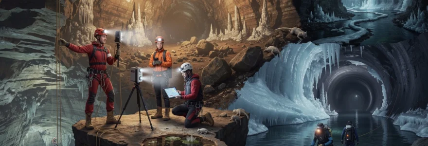
Speleological mapping technologies and cave survey methodologies
Modern speleology depends heavily on accurate cave mapping to document passage geometry, assess hazards, and guide both scientific research and conservation efforts. Traditional tape-and-compass surveys have increasingly been augmented by digital instruments, 3D scanning, and advanced underwater mapping tools. These technologies not only improve precision but also allow researchers to visualize complex cave systems in ways that were impossible just a few decades ago. By combining cave survey methodologies with GIS platforms, scientists can analyze underground drainage networks, model airflow patterns, and even simulate flood events.
Lidar scanning and 3d photogrammetry in carlsbad caverns, new mexico
Carlsbad Caverns in New Mexico has become a showcase for the use of LiDAR scanning and 3D photogrammetry in large cave chambers. LiDAR (Light Detection and Ranging) systems emit laser pulses and measure their return times to create highly accurate point clouds of cave walls, ceilings, and formations. When combined with high-resolution photographic data, these scans produce textured 3D models that capture even fine speleothem details. For park managers, such digital replicas support infrastructure planning, hazard assessment, and virtual tours that reduce the need for physical foot traffic in fragile areas.
For you as an explorer or researcher, 3D cave mapping offers additional benefits. Detailed models allow route planning in complex passages, identification of potential new leads, and re-analysis of features from a desktop instead of requiring multiple in-person visits. These virtual caves can also be shared with educators and the public, turning inaccessible or hazardous sections into safe, immersive learning environments. In a sense, LiDAR and photogrammetry let us “bring the cave to the surface,” preserving a digital time capsule that can be revisited as formations and conditions slowly change.
Distox2 digital survey instruments for passage measurement
While large-scale scanning grabs headlines, much of everyday cave survey work still relies on portable instruments such as the DistoX2. This compact device combines a laser distance meter with an electronic compass and clinometer, transmitting data via Bluetooth to cave survey software. Surveyors can quickly record shot lengths, azimuths, and inclinations, drastically reducing transcription errors compared to paper-based methods. When hundreds or thousands of survey stations are involved, this time savings and accuracy improvement become significant.
If you participate in cave mapping projects, learning proper DistoX2 techniques is a valuable skill. Teams typically establish a series of stations along the passage, shooting between them while also recording passage dimensions and notable features. Once imported into software like PocketTopo or Therion, the data yields plan, profile, and extended elevation views of the cave. Although the technology has advanced, the underlying principles—careful station placement, redundancy, and meticulous note-taking—remain as important as ever for producing high-quality maps.
Underwater cave mapping techniques in sistema sac actun, mexico
Underwater cave systems such as Sistema Sac Actun in Mexico, one of the longest known underwater cave networks on Earth, present unique mapping challenges. Survey divers must contend with limited visibility, equipment constraints, and strict gas management while laying guideline and taking measurements. Traditional methods use knotted lines, slate notes, and compasses, but newer approaches incorporate digital compasses, inertial navigation systems, and side-scan sonar in flooded passages. In some projects, rebreathers extend bottom times, allowing more comprehensive surveying in a single dive.
Accurate underwater cave mapping is essential not only for exploration but also for understanding regional groundwater flow and contamination risks in karst aquifers. In the Yucatán Peninsula, for example, cave conduits connect sinkholes, cenotes, and coastal discharge points, forming critical freshwater pathways. By integrating depth data, passage geometry, and water chemistry measurements, researchers can build 3D models of these submerged networks. For divers, carefully following established survey lines and respecting no-touch policies for fragile decorations are key practices that support both safety and scientific integrity in underwater caves.
Speleothem formations and palaeoclimatic research applications
Speleothems—mineral deposits such as stalactites, stalagmites, flowstones, and cave pearls—are more than just spectacular cave decorations. These formations grow when mineral-rich water drips or flows through cave air, precipitating calcite, aragonite, or other minerals over thousands to hundreds of thousands of years. Because speleothems often record changes in drip-water composition, temperature, and rainfall, they serve as valuable archives of past climate conditions. Analyses of stable isotopes, trace elements, and growth banding allow palaeoclimatologists to reconstruct regional climate history in remarkable detail.
How do cave formations encode climate information? As rainwater infiltrates soils and bedrock, it absorbs carbon and oxygen isotopes whose ratios vary with temperature, vegetation, and evaporation patterns. When that water deposits calcite in a stalagmite, the isotopic signature is locked into successive layers, much like tree rings. By sampling these layers with micro-drills and applying precise uranium-thorium dating, researchers can generate chronologies spanning glacial–interglacial cycles. In many regions, cave speleothems provide higher-resolution and better-dated records than lake sediments or marine cores, especially for reconstructing monsoon intensity and drought frequency.
From a conservation standpoint, the scientific value of speleothems underscores the need for strict protection of cave formations. Even a single touch can leave oils that alter growth surfaces, while breakage or souvenir collecting permanently destroys climate records that cannot be replaced. When you visit show caves, staying on designated paths and following lighting guidelines helps limit algae growth and thermal changes that might affect speleothem development. For researchers, non-destructive techniques such as CT scanning and in-situ micro-sampling are increasingly preferred, balancing data needs with the preservation of these natural climate archives.
Technical caving equipment and vertical rope access systems
Exploring deep or vertical cave systems safely requires specialized technical caving equipment and well-practiced rope access techniques. Unlike casual show-cave visits, vertical caving—often called single rope technique (SRT)—involves ascending and descending fixed ropes using mechanical ascenders, descenders, and harness systems. Helmets with reliable lighting, layered thermal clothing, and robust footwear are essential in most underground environments, where temperatures are cool and humidity remains high. Proper equipment selection and inspection reduce the risk of accidents, while training ensures that you can respond effectively to unexpected conditions.
Vertical rope systems in caves must account for sharp edges, water flow, and potential rockfall. Cavers typically use low-stretch (static) ropes anchored to natural features or installed bolts, backed up with redundancy to safeguard against failure. Descents are managed with devices such as bobbins or rack descenders, which provide controlled friction on the rope, whereas ascents rely on chest and hand ascenders linked to foot loops. Because caves can be analogized to “three-dimensional mazes made of stone,” effective rope rigging not only moves you up and down but also positions you away from hazards and toward safe rebelays and deviations.
For those new to technical caving, structured training with experienced instructors is crucial before attempting complex vertical routes. Practice sessions in controlled environments—such as climbing towers or small training pits—allow you to master knot tying, changeovers between ascending and descending, and self-rescue techniques. Many caving organizations publish equipment guidelines and rigging topos for well-known vertical caves, helping teams plan safe descents and ascents. Ultimately, high-quality gear is only one part of safe vertical caving; risk assessment, communication, and clear emergency plans are just as important when venturing into deep shafts or multi-pitch drops.
Conservation challenges and limestone degradation management
As interest in underground tourism and adventure caving grows, conservation challenges in fragile cave environments have become more pressing. Human presence can accelerate limestone degradation through physical abrasion, introduction of contaminants, and changes in cave microclimates. Even seemingly minor impacts—mud tracked onto formations, increased carbon dioxide from visitors, or artificial lighting—can cumulatively alter speleothem growth and cave biology. Effective cave conservation management therefore seeks to balance access and enjoyment with long-term protection of geological and ecological features.
In limestone caves, degradation often manifests as broken formations, discoloration from touching, and corrosion linked to altered air circulation. Managers employ strategies such as limiting visitor numbers, designing elevated pathways, and using low-heat, spectrum-controlled lighting to minimize algae growth. In sensitive areas, gates and restricted zones prevent unregulated entry, while monitoring programs track changes in temperature, humidity, and CO2 levels. Just as we might protect a rare manuscript in a climate-controlled archive, caves require careful environmental management to preserve their “pages” of geological and climatic history.
For individual cavers and tourists, practicing minimal-impact techniques is one of the most direct ways to support limestone cave conservation. This includes staying on marked routes, avoiding contact with formations, packing out all waste, and respecting access guidelines set by local clubs and land managers. Participation in cave clean-up events, monitoring projects, or bat surveys can also turn recreational interest into active stewardship. As we continue exploring caves and underground wonders around the world, adopting a conservation-first mindset ensures that these extraordinary environments remain intact for future generations of scientists, explorers, and curious visitors.


