London’s transport network represents one of the world’s most comprehensive urban mobility systems, yet its complexity often intimidates first-time visitors and new residents alike. With over 270 Underground stations, 700 bus routes, and multiple rail services spanning nine distinct zones, navigating the capital can initially seem daunting. However, understanding the fundamental structure of Transport for London’s integrated network transforms what appears overwhelming into an efficient, user-friendly system that connects every corner of the metropolis.
The key to mastering London’s transport lies not in memorising every route, but in understanding the strategic principles that govern how different modes of transport interconnect. Modern digital tools have revolutionised journey planning, whilst contactless payment systems have eliminated many traditional barriers to seamless travel. Whether you’re commuting during peak hours or exploring tourist destinations at weekends, the same core navigation principles apply across all scenarios.
Understanding london’s transport for london (TfL) network architecture
Transport for London operates as an integrated transport authority that coordinates multiple transport modes under a unified fare structure. The network encompasses the Underground, Overground, buses, trams, river services, and cycle hire schemes, all designed to work in harmony rather than as competing systems. This integration means that a single journey can seamlessly combine multiple transport modes without requiring separate tickets or payment methods.
Decoding the zone system from central london to zone 9
London’s zone system forms the backbone of the city’s fare structure, with Zone 1 encompassing central London’s core attractions and business districts. The zones radiate outward concentrically, with most tourist destinations falling within Zones 1-3. Zone boundaries don’t always follow logical geographical patterns, as some stations sit on zone boundaries, offering passengers the benefit of the lower zone fare regardless of their direction of travel.
Understanding zone implications becomes particularly important for longer journeys, as crossing multiple zones significantly impacts fare costs. For instance, travelling from Heathrow (Zone 6) to central London requires crossing five zone boundaries, making it one of the more expensive single journeys on the network. However, daily and weekly fare capping ensures that frequent travellers never pay more than the equivalent period pass, regardless of how many individual journeys they make.
Underground line interconnections at major interchange stations
Major interchange stations like King’s Cross St Pancras, Oxford Circus, and London Bridge function as the nervous system of London’s transport network. These hubs connect multiple Underground lines, National Rail services, and bus routes, creating countless routing possibilities for any given journey. King’s Cross St Pancras alone serves six different Underground lines plus international, national, and suburban rail services, making it one of Europe’s busiest transport interchanges.
Navigating these complex interchanges requires understanding the physical layout of each station, as some connections involve considerable walking distances or multiple escalator journeys. The newer Elizabeth Line stations feature step-free access and clearer signage, setting new standards for interchange design that older stations are gradually adopting through ongoing modernisation programmes.
Overground, DLR, and elizabeth line integration points
The London Overground network serves areas that the Underground doesn’t reach effectively, particularly in South and East London. Unlike the deep-level Underground lines, Overground services operate on surface-level tracks, offering passengers views of London’s diverse neighbourhoods whilst maintaining Underground-style frequency and reliability. The Docklands Light Railway (DLR) provides automated train services connecting the financial district of Canary Wharf with surrounding areas, including London City Airport.
The Elizabeth Line represents London’s most significant transport investment in decades, connecting Reading and Heathrow in the west with Shenfield and Abbey Wood in the east. This new line reduces journey times between major destinations by up to 30 minutes, whilst providing step-free access and larger, more comfortable trains than traditional Underground services. Integration points between these services create opportunities for creative routing that can avoid congested sections of the traditional Underground network.
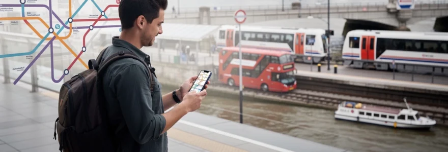
Real-time service status monitoring through TfL go application
The TfL Go application provides real-time service updates, journey planning, and disruption information across all London transport modes. Unlike third-party applications, TfL Go accesses live operational data directly from Transport for London’s control systems
The app’s map view highlights stations with disruptions, planned engineering works, and crowding levels, allowing you to adjust your route before you descend into a station. You can filter for specific lines, check first and last train times, and see live departure boards for buses, Tube, Overground, DLR, and the Elizabeth Line. If you enable location services, TfL Go can also surface contextual alerts, such as advising alternative routes when there is a signal failure or severe delays. Using TfL Go alongside a general navigation app creates a powerful toolkit for staying ahead of unexpected issues and keeping your journeys in London calm and predictable.
Strategic route planning using digital navigation tools
Digital navigation tools have transformed how both visitors and locals plan journeys across London. Instead of memorising lines and interchanges, you can rely on smart algorithms that factor in walking distances, disruption data, and even your preferred mode of transport. Combining specialist transport apps with general mapping tools allows you to choose between the fastest, cheapest, or most scenic route. In practice, most Londoners switch between a small set of apps depending on the type of journey they are making and how time-sensitive it is. Learning how to use these tools strategically is one of the fastest ways to get around London without feeling overwhelmed.
Citymapper algorithm optimisation for multi-modal journeys
Citymapper is often regarded as the gold standard for getting around London on public transport. Its routing engine is designed specifically for complex, multi-modal journeys, which means it can suggest combinations of Tube, bus, walking, Overground, and even Santander Cycles in a single itinerary. When you enter your destination, Citymapper automatically weighs variables like live disruption, walking time between platforms, and expected delays to propose realistic journey options rather than just theoretical ones.
You can tailor these suggestions using Citymapper’s settings to match your travel preferences. For example, you can tell the app to minimise walking, avoid certain lines, or cap your journey cost by prioritising buses over the Tube. Curious how long it really takes to walk from one station to another on the same line? Citymapper will compare a short Tube hop versus a street-level walk, often revealing that walking around central London is quicker and less stressful. Treat it as your London-savvy friend who quietly runs the maths for every possible route so you do not have to.
Google maps live traffic data integration for london streets
While Citymapper excels at public transport planning, Google Maps remains invaluable for understanding London’s road network. Its live traffic overlays show congestion hotspots, road closures, and estimated journey times for taxis, ride-hailing services, and private cars. If you are deciding whether to take a black cab across town or switch to the Tube, a quick glance at Google’s traffic layer can be the difference between a smooth ride and being stuck on the Strand for forty minutes.
Google Maps also shines when it comes to walking and cycling routes. The app’s real-time pedestrian directions help you navigate complex junctions, bridges, and backstreets, often suggesting quieter or more scenic paths. Think of it as a street-level complement to the more network-focused transport apps: where Citymapper optimises your interactions with the TfL system, Google Maps helps you interpret the actual geography of London’s neighbourhoods. Using both together gives you a fuller picture of how long your journey will really take from door to door.
Tfl journey planner accessibility features and step-free access
The TfL Journey Planner, available on the TfL website and within TfL Go, offers a depth of accessibility-focused options that many third-party tools cannot match. When planning a route, you can filter specifically for step-free access, choosing between “step-free to platform” or “step-free to train.” This distinction matters: some stations have lifts to platforms but still require a step or small gap to board the train, while others offer level boarding throughout.
For travellers using wheelchairs, pushing prams, or carrying heavy luggage, the Journey Planner’s accessibility filters can transform a stressful trip into a manageable one. You can exclude stations with long passageways, narrow corridors, or broken lifts, as TfL’s data reflects planned lift maintenance and closures. In addition, the planner highlights interchange times and suggests alternative routes where a single step-free change replaces multiple stair-heavy changes. By using these tools proactively, you can design journeys that fit your mobility needs instead of adapting on the fly in crowded stations.
Offline navigation solutions for underground dead zones
Although Wi‑Fi is widely available in London stations and 4G/5G coverage is improving, you will still encounter Underground “dead zones” where data signals drop out. Preparing for this in advance keeps you from feeling stranded halfway through a journey. Most major apps, including Citymapper and Google Maps, allow you to pre-load routes, which remain accessible even when your connection disappears. Once you have your journey planned, the turn-by-turn steps are usually cached on your device.
For extra resilience, you can download offline maps for central London within Google Maps, so you can still see your location and nearby streets when you emerge from a station. Many travellers also take a quick screenshot of their route overview or a Tube map before they go underground, giving them a simple visual reference if all else fails. Think of these strategies like carrying a paper map in your back pocket: you may not need it most of the time, but when you do, it dramatically reduces stress.
Payment systems and fare optimisation strategies
London’s contactless payment system is designed to make paying for travel almost invisible, yet understanding how it works can save you a significant amount of money. Whether you use a contactless bank card, a mobile wallet, or an Oyster card, the system automatically calculates your fares and applies daily and weekly caps. However, there are subtle differences between these options that affect how much you pay and how flexible your travel can be. By approaching payments strategically, you can move around London like a local while keeping your transport budget firmly under control.
Contactless payment vs oyster card cost analysis
From a fare perspective, contactless and Oyster cards generally charge the same pay-as-you-go rates across buses, Tube, DLR, Overground, and most rail services within London zones. The main difference lies in how each system handles capping and long-term use. For short visits of a few days, a contactless card or mobile wallet is often simplest: you avoid the £5 Oyster deposit and do not have to worry about topping up, as charges apply directly to your bank account.
However, Oyster cards can still be advantageous in certain scenarios. Children, students, and some concession travellers benefit from discounted Oyster fares that are not available on standard contactless cards. If you are uncomfortable with foreign transaction fees on your bank card, loading local currency onto an Oyster card gives you predictable costs with no extra bank charges. For regular commuters, season tickets and travelcards still sit more naturally on Oyster, particularly for journeys that extend beyond London’s contactless boundary.
Daily and weekly fare capping mechanisms across zones
Fare capping is one of the most powerful features of London’s payment system, ensuring you never pay more than the equivalent of a travelcard for the zones you have used. Once your combined journeys reach the cap for a given day, any additional travel in the same zones is effectively free. For example, a visitor making multiple trips across Zones 1–2 will automatically stop being charged once they hit the daily cap, regardless of how many buses or Tube rides they take.
Weekly capping adds another layer of savings, particularly if you are in London from Monday to Sunday. With contactless payments, the system looks at your total travel for the week and retroactively applies the cheapest possible cap for the zones you used most. This is like having a flexible travelcard that adjusts to your behaviour instead of forcing you to commit in advance. To benefit fully, ensure you always use the same card or device to tap in and out, so the system can correctly link your journeys and apply the cumulative discounts.
Apple pay and google pay integration with TfL readers
Mobile wallets such as Apple Pay and Google Pay integrate seamlessly with TfL’s yellow card readers, offering the same fares and capping rules as physical contactless cards. For many visitors, using a phone or smartwatch is more convenient and secure than carrying a separate bank card, especially in busy environments. You simply add your card to your device’s wallet app, authenticate as required, and tap on and off as you would with a normal contactless card.
There are, however, a few practical points to remember. Always use the same device for every part of your journey: if you tap in with your phone and tap out with your watch, the system treats these as two separate cards and can charge you incomplete journey fares. It is also wise to ensure your device is sufficiently charged before a long day of sightseeing—running out of battery at a ticket gate is an avoidable source of stress. Used correctly, mobile wallets offer a streamlined, highly flexible way to pay your way around London’s public transport network.
Peak hour traffic management and alternative routing
Rush hour in London can feel intense, particularly on central Tube lines and major bus corridors. Weekday peaks typically fall between 07:30–09:30 and 17:00–19:00, when commuters flood into and out of Zone 1. If you must travel during these windows, a little planning goes a long way towards keeping your journey manageable. Avoiding the most crowded sections, choosing alternative lines, or adjusting your schedule by even fifteen minutes can dramatically change your experience.
One effective technique is to leverage orbital routes instead of travelling through central bottlenecks. For example, the London Overground’s orbital lines or the Elizabeth Line’s cross-city services can sometimes bypass congested Underground segments while maintaining similar journey times. Buses also become more attractive during off-peak periods, offering direct surface routes that feel calmer and more spacious than packed Tube carriages. Ask yourself: is speed the only priority for this trip, or would a slightly slower but more comfortable route leave you feeling less drained?
Tourist-specific navigation from major landmarks
Many visitors to London build their itineraries around a handful of landmark clusters, and understanding the best routes between them can save both time and energy. Instead of defaulting to the Tube for every connection, you can often combine walking, buses, and river services to turn simple transfers into memorable parts of your trip. The following routes illustrate how to get around London like a local while moving between some of the city’s most popular sights.
Westminster to tower bridge via south bank walking route
The stretch of riverfront between Westminster and Tower Bridge is one of London’s most rewarding urban walks, turning a basic transfer into a highlight of your visit. Starting at Westminster Underground station, you can emerge near the Houses of Parliament and cross Westminster Bridge for classic views of Big Ben and the London Eye. From here, follow the South Bank eastwards along the Thames Path, passing cultural landmarks such as the Southbank Centre, Shakespeare’s Globe, and Tate Modern.
Continuing further, you will approach Borough Market and the Shard, before eventually reaching the historic Tower of London and Tower Bridge. Depending on your pace and how often you stop for photos or coffee, the entire route can take 60–90 minutes, yet it often feels shorter thanks to the constant visual interest. If your legs tire, you can always hop onto a river bus or a nearby Tube station to complete the journey. For many travellers, this river walk offers a more vivid introduction to the city than any underground transfer ever could.
King’s cross st pancras international to covent garden connections
King’s Cross St Pancras International is a major gateway for Eurostar passengers and long-distance rail travellers, many of whom head straight to Covent Garden. The most obvious option is to take the Piccadilly Line westbound for a few stops, but this can be crowded at peak times. An alternative is to walk or take a short bus ride, which allows you to see more of the city and avoid busy platforms.
On foot, the route from King’s Cross to Covent Garden takes around 20–25 minutes, leading you past Bloomsbury’s garden squares and the British Museum area. Buses from Euston Road or nearby stops can also drop you within a short stroll of Covent Garden, often in a similar total time once you factor in walking through the station. Treat this connection as a gentle introduction to London’s West End rather than just another transfer. By staying above ground for part of your journey, you will quickly build a mental map of how central districts fit together.
Heathrow terminal access to central london hotel districts
Arriving at Heathrow can be one of the most overwhelming moments of a London trip: you are jet-lagged, managing luggage, and trying to choose between multiple transport options. The Elizabeth Line and the Piccadilly Line both provide direct links to central London, with the Elizabeth Line generally offering faster, more spacious trains and step-free access. If you are heading to areas like Paddington, Tottenham Court Road, or Liverpool Street, the Elizabeth Line’s cross-city routing is particularly convenient.
The Piccadilly Line, meanwhile, is often the best-value option, especially if you are staying in hotel districts such as Earls Court, South Kensington, or Russell Square. For travellers prioritising comfort and minimal changes, dedicated airport express services and pre-booked taxis or minicabs remain alternatives, albeit at a higher cost. A useful rule of thumb is to weigh three factors: budget, luggage load, and your tolerance for crowds. If you are travelling light and want to get a feel for London’s public transport immediately, the Tube or Elizabeth Line are excellent choices. With heavy bags or mobility needs, you might prefer to invest in a more direct, door-to-door service.
Greenwich maritime quarter to canary wharf via thames clipper
The route between Greenwich and Canary Wharf is a perfect example of how river services can be both practical and pleasurable. Instead of taking the DLR, you can board a Thames Clippers river bus from Greenwich or Cutty Sark piers and glide up the Thames to Canary Wharf. The journey typically takes around 10–15 minutes, offering striking views of the O2, historic docklands, and the emerging skyline of East London.
Using the river in this way can feel almost like a sightseeing cruise that just happens to double as public transport. Fares are higher than a standard Tube or DLR journey, but contactless and Oyster are accepted, and there are daily caps that keep costs reasonable if you make several river trips. If you are exploring Greenwich’s maritime heritage in the morning and have afternoon plans in Canary Wharf’s shopping malls or restaurants, the river bus is an atmospheric bridge between two very different sides of London life.
Emergency protocols and service disruption management
Even in a well-managed system like London’s, service disruptions, delays, and occasional emergencies are inevitable. Knowing how to respond calmly and efficiently can make the difference between a minor inconvenience and a truly stressful experience. Most disruptions fall into predictable categories—signal failures, staff shortages, planned engineering works—and are communicated quickly via station announcements, TfL Go alerts, and platform displays. Treat these as cues to reassess your route rather than reasons to panic.
If a line is suspended or severely delayed, your first step should be to check TfL Go or Citymapper for alternative routes, which often suggest buses, walking links, or parallel lines that bypass the problem area. In more serious situations, such as an emergency evacuation, always follow staff instructions and signage, even if this means leaving the station and continuing your journey above ground. London’s dense network usually offers multiple paths between any two points, so a blocked route rarely means you are stuck. By combining basic awareness of emergency protocols with flexible use of digital tools, you can keep moving around London confidently, even when the unexpected occurs.


