Istanbul stands as the world’s only city spanning two continents, where Europe and Asia meet across the magnificent Bosphorus Strait. This unique geographical position has shaped the city’s transportation infrastructure into one of the most complex and fascinating urban mobility systems globally. With over 16 million residents navigating daily between continental shores, Istanbul has developed an intricate network of bridges, tunnels, ferries, and rail systems that seamlessly connect two worlds. The city’s transportation evolution reflects centuries of strategic importance as a bridge between civilizations, now transformed into a modern metropolis where ancient trade routes coexist with cutting-edge transit technology.
Strategic Cross-Continental transportation networks in istanbul
Istanbul’s transportation infrastructure represents a masterpiece of engineering ambition, designed to handle one of the world’s most challenging urban mobility scenarios. The city’s strategic position has necessitated innovative solutions that go far beyond conventional urban planning, creating a multi-modal transportation ecosystem that serves as a model for other transcontinental cities worldwide.
Bosphorus bridge engineering and traffic flow dynamics
The Bosphorus Bridge, inaugurated in 1973, marked a revolutionary moment in Istanbul’s transportation history. This suspension bridge stretches 1,560 metres across the strait, connecting the Ortaköy district on the European side with Beylerbeyi on the Asian shore. The bridge’s engineering specifications include a main span of 1,074 metres, making it one of the longest suspension bridges in the world at the time of construction.
Traffic flow dynamics across this vital artery present unique challenges that traffic engineers continuously monitor and optimise. During peak hours, the bridge handles approximately 200,000 vehicles daily, creating bottlenecks that require sophisticated traffic management systems. The adaptive traffic signal coordination implemented around bridge approaches helps maintain flow efficiency, though congestion remains a persistent challenge during rush periods.
Fatih sultan mehmet bridge structural specifications
The second Bosphorus crossing, completed in 1988, was designed to alleviate pressure on the original bridge while accommodating Istanbul’s rapidly growing population. The Fatih Sultan Mehmet Bridge features a total length of 1,090 metres with a main span of 1,090 metres, positioned strategically in the northern corridor of the city to distribute cross-continental traffic more effectively.
This bridge incorporates advanced wind resistance engineering, crucial for spanning the Bosphorus where strong currents create challenging atmospheric conditions. The structure’s aerodynamic design and cable-stayed configuration enable it to withstand wind speeds up to 180 kilometres per hour, ensuring year-round operational reliability for the estimated 150,000 vehicles that cross daily.
Yavuz sultan selim bridge third crossing infrastructure
The Yavuz Sultan Selim Bridge, opened in 2016, represents the pinnacle of modern bridge engineering in Istanbul’s transportation network. This hybrid cable-stayed and suspension bridge spans 2,164 metres, making it the widest suspension bridge globally with eight lanes for vehicular traffic plus two railway lines for high-speed rail connections.
The bridge’s integrated transportation approach revolutionised cross-continental connectivity by combining road and rail infrastructure in a single structure. Its strategic location in Istanbul’s northern corridor serves as a bypass for international transit traffic, reducing congestion on the older bridges while supporting the city’s role as a transcontinental logistics hub. The structure handles approximately 135,000 vehicles daily while simultaneously accommodating freight and passenger rail services.
Eurasia tunnel underwater engineering marvel
The Eurasia Tunnel, operational since 2016, showcases Istanbul’s commitment to innovative transportation solutions through underwater engineering excellence. This 14.6-kilometre tunnel system, with 5.4 kilometres running beneath the Bosphorus seafloor, connects Kazlıçeşme on the European side with Göztepe on the Asian shore at depths reaching 106 metres below sea level.
The tunnel’s dual-tube design features advanced ventilation systems, fire safety protocols, and real-time traffic monitoring capabilities that ensure safe passage for approximately 120,000 vehicles daily. The engineering achievement required overcoming significant geological challenges, including seismic activity considerations and
integrated flood-prevention measures. Engineers designed flexible joints and seismic isolation systems that allow the structure to absorb tremors rather than transmit them directly to the tunnel walls. For drivers, this complex engineering translates into a simple experience: a faster, weather-independent alternative to surface crossings that can cut journey times between continents to as little as 15 minutes outside peak hours. Dynamic toll pricing and real-time traffic control help regulate vehicular volumes, making the Eurasia Tunnel a critical component of Istanbul’s multi-layered cross-continental road network.
Marmaray railway cross-continental integration system
The Marmaray railway system is often described as the backbone of cross-continental public transport in Istanbul. Opened in stages from 2013, this rail corridor includes a 13.6-kilometre section with a 1.4-kilometre immersed tube tunnel running beneath the Bosphorus, reaching depths of around 60 metres. Unlike road tunnels, Marmaray is dedicated to rail, carrying high-capacity commuter trains that link Halkalı in the west to Gebze in the east, effectively stitching together distant suburbs on both continents into a single, continuous rail spine.
From a systems integration perspective, Marmaray’s greatest achievement lies in unifying previously fragmented suburban lines into a coherent, high-frequency service. Modern signalling technology, including automatic train protection and real-time monitoring, enables short headways and safe operations even during peak demand when trains can run as often as every few minutes. For daily commuters navigating Istanbul between two continents, Marmaray significantly reduces dependence on bridges and buses, offering a predictable, weather-proof and congestion-free alternative.
Beyond passenger mobility, Marmaray also has a strategic role in freight logistics by forming a key rail link in the broader Europe–Asia supply chain. Trains can now cross from the European railway network into Anatolia without transhipment, enhancing Istanbul’s position as a transcontinental logistics hub. If you consider the Bosphorus as a previously hard boundary, Marmaray acts like a hidden zipper beneath the water, quietly fastening two sides of the city into a single, integrated rail ecosystem.
Metropolitan transit systems connecting europe and asia
While bridges and tunnels provide the structural framework for crossing the Bosphorus, it is Istanbul’s metropolitan transit systems that animate this framework with daily human movement. A dense web of metro lines, bus corridors, ferries, and shared taxis ensures that residents can choose from multiple modes when planning an intercontinental journey. Each system has a distinct role: some optimise speed, others prioritise coverage or cost efficiency, and many are designed to integrate seamlessly with one another through coordinated schedules and shared ticketing.
For visitors, this multi-layered transport environment can initially feel overwhelming. Yet, once you understand how the core systems connect across the Bosphorus Strait, navigating Istanbul becomes surprisingly intuitive. A well-planned trip might involve taking a metro line under the water, transferring to a Metrobus on a dedicated lane, and finishing with a short ferry ride—three different modes, but one continuous journey. The city’s planning authorities increasingly view these elements as parts of a single, integrated mobility service rather than isolated infrastructure projects.
Metro line extensions across bosphorus strait
Istanbul’s expanding metro network plays a crucial role in easing pressure on road bridges and surface traffic. Several lines now cross or directly connect to Bosphorus transit points, with new extensions designed explicitly to support intercontinental commuting. For example, the M2 and M7 lines on the European side interface with transfer hubs that feed into Marmaray and other cross-continental links, while the M4 line on the Asian side connects key residential districts to ferry terminals and tunnel access points.
Recent and planned metro extensions focus on shortening end-to-end travel times for people living far from the central business districts. By providing high-frequency, grade-separated rail service, these lines bypass the most congested road corridors, turning what might have been an hour-long bus ride into a 25-minute metro journey. Have you ever considered how much of your day is lost in traffic? For Istanbul residents, metro expansions across the Bosphorus Strait reclaim that time and translate it into improved quality of life and economic productivity.
From an engineering and urban planning perspective, each new metro segment is carefully aligned with projected population growth and land-use changes. Transit-oriented development around new stations encourages denser, mixed-use neighbourhoods that reduce the need for long intercontinental commutes in the first place. In this way, metro line extensions are not just transport projects; they are catalysts for reshaping how Istanbul develops on both its European and Asian shores.
Metrobus rapid transit dedicated lane network
The Metrobus system is Istanbul’s answer to the need for a rapid, bus-based corridor that can cross continents without being trapped in ordinary traffic. Running along a 50-kilometre dedicated lane network, Metrobus connects Avcılar on the European side to Söğütlüçeşme on the Asian side via the Bosphorus Bridge. Because buses operate in segregated lanes, they bypass congestion that affects regular buses and private vehicles, delivering a more predictable intercontinental travel time even during rush hours.
From an operational standpoint, Metrobus resembles a surface metro more than a traditional bus route. High-capacity articulated buses, platform-level boarding, and frequent intervals—sometimes less than two minutes—create a continuous flow of passengers moving between continents. For commuters who do not live near a metro station or Marmaray line, Metrobus often becomes the fastest and most cost-effective option. Think of it as a conveyor belt laid across the city: you step on at one end of Istanbul and step off on the other, with minimal friction along the way.
However, Metrobus also illustrates the challenges of scaling bus rapid transit in a mega-city. Overcrowding during peak periods can be intense, and any disruption on the dedicated corridor can have a network-wide impact. To mitigate these issues, authorities invest in fleet upgrades, signal priority at crossings, and improved passenger information systems. As Istanbul continues to navigate mobility between two continents, the Metrobus dedicated lane network remains a crucial, if heavily used, pillar of the transit ecosystem.
Ferry terminal operations at eminönü and karaköy
Despite all the high-tech tunnels and rapid transit lines, ferries retain a central and symbolic role in Istanbul’s intercontinental mobility. Eminönü and Karaköy, located on the European shore of the Golden Horn, operate as key ferry hubs linking districts such as Üsküdar and Kadıköy on the Asian side. These terminals handle tens of thousands of passengers daily, blending routine commuter flows with the constant presence of tourists seeking the classic Bosphorus crossing experience.
Operational efficiency at these terminals depends on precise scheduling, rapid boarding procedures, and seamless integration with land-based transport. Ferries are timed to connect with tram lines, buses, and metro services, enabling passengers to step off the boat and immediately continue their journeys. For you as a traveller, this coordinated network means you can often make a cross-continental trip with a single transfer and minimal waiting time. The ferries themselves function like floating buses, with standardised fares via the Istanbul Kart and frequent departures during peak hours.
Ferry operations also serve a strategic redundancy function for Istanbul’s transit system. When bridges are congested or tunnels face temporary closures, additional ferry services can be deployed as a relief valve for the network. Moreover, the experience of crossing the Bosphorus by boat offers a unique perspective on the city’s geography, helping you visually understand how Istanbul’s European and Asian districts interlock along the strait. In many ways, the humble ferry remains the most poetic answer to the question of how to navigate a city built between two continents.
Dolmuş route optimisation between continental districts
For more flexible, point-to-point travel between neighbourhoods, Istanbul relies on dolmuş, the shared minibus or taxi-van services that operate on semi-fixed routes. While dolmuş cannot directly cross the Bosphorus by water, many routes are carefully optimised to feed into key crossing points such as ferry terminals, Metrobus stops, and tunnel entrances. This creates a fine-grained mobility layer that reaches residential streets and commercial areas not well served by heavy rail or high-capacity buses.
Route optimisation for dolmuş services is an ongoing process that responds quickly to changing travel patterns. Operators adjust frequencies based on observed demand, peak travel times, and seasonal tourism flows, often more dynamically than formal public transport services can manage. Have you ever noticed how small vehicles seem to find shortcuts that big buses cannot use? Dolmuş services leverage this agility to provide last-mile connectivity that complements the larger intercontinental corridors.
From the user’s perspective, dolmuş can be an efficient way to navigate complex journeys across Istanbul between two continents, especially when combined with metro or ferry transfers. However, the informality of some routes can also pose challenges, such as inconsistent schedules or limited information for first-time riders. City authorities increasingly explore ways to better integrate dolmuş into official planning frameworks, including digital mapping and payment systems, while preserving the flexibility that makes this mode so valuable to local commuters.
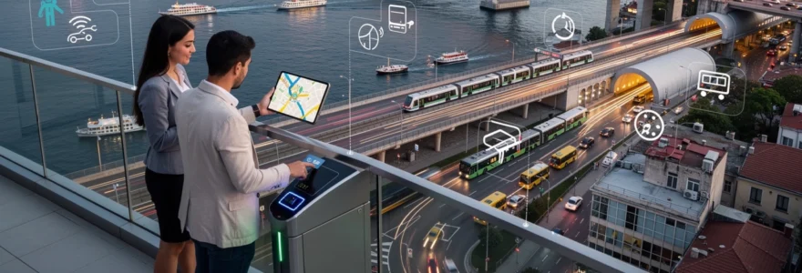
Digital navigation technologies for intercontinental routes
As Istanbul’s physical transport network has grown more sophisticated, digital tools have become essential for making sense of the many available options. Real-time navigation apps, integrated payment platforms, and predictive traffic systems now guide millions of daily decisions about how to move between continents. For both residents and visitors, effective use of these technologies can mean the difference between a smooth, 30-minute cross-continental journey and a frustrating, two-hour ordeal stuck in congestion.
Digital navigation in Istanbul goes beyond simple point-to-point directions. Modern platforms analyse historical data, live sensor feeds, and user-generated reports to recommend not only the fastest route but also the most reliable mode at a given time of day. When you open a mobility app in Istanbul, you are effectively consulting a constantly updated model of the city’s transport metabolism—an invisible layer of intelligence sitting on top of bridges, tunnels, ferries, and metro lines.
Bitaksi and uber algorithmic route planning
Ride-hailing services such as BiTaksi and Uber play a significant role in personalised navigation between Istanbul’s European and Asian sides. Their algorithms evaluate a range of factors—current demand, road congestion, toll costs, and even historical travel times across specific Bosphorus crossings—to determine optimal pickup and drop-off routes. For example, at certain hours it may be faster to use the Eurasia Tunnel than the Bosphorus Bridge, even if the tunnel route appears longer in distance.
These platforms also help aggregate transport supply by matching passengers heading in similar directions, particularly during peak commuting windows between continents. Pooling features, when available, reduce the total number of vehicles crossing the Bosphorus at any given moment, easing pressure on critical infrastructure. For you as a user, the advantage lies in not having to decide which bridge or tunnel is best; the algorithm makes that decision based on a far richer dataset than any single driver could process alone.
However, algorithmic route planning in Istanbul must constantly adapt to unpredictable variables such as accidents, sudden weather changes, or spontaneous road closures. This is where real-time feedback loops—drivers reporting incidents, users rating trips, and sensors collecting live traffic data—feed back into the system to refine recommendations. In a city literally spanning two continents, these dynamic, data-driven tools have become as integral to daily mobility as the physical roads themselves.
Istanbul kart RFID payment integration systems
The Istanbul Kart is the unifying thread that ties together most public transport modes across the city, from metros and buses to ferries and some dolmuş services. Using RFID technology, this contactless smart card allows passengers to tap in and out across multiple systems without needing separate tickets for each segment of an intercontinental journey. A single card can take you from a tram in Sultanahmet to a ferry in Eminönü and then onto a bus in Kadıköy, all with seamless payment integration.
From a systems design perspective, Istanbul Kart functions as both a payment instrument and a valuable data source. Aggregated, anonymised usage patterns help planners understand how people actually move between the European and Asian sides, informing decisions about where to add capacity or adjust schedules. For example, spikes in morning validations at certain ferry terminals might trigger additional boat deployments or improved bus connections on the Asian shore.
For everyday users, the benefits are practical and immediate. You can top up your card online, at kiosks, or via mobile apps, reducing the need to queue for paper tickets at busy stations. Fare discounts for transfers encourage multimodal journeys, making it more cost-effective to combine metro, bus, and ferry in a single cross-continental trip. In effect, Istanbul Kart turns the city’s complex transport landscape into a single, unified service from a payment and user-experience perspective.
Moovit real-time transit API implementation
Apps like Moovit leverage real-time transit APIs to provide detailed, step-by-step guidance across Istanbul’s extensive network. By integrating official data feeds from metro, bus, and ferry operators with crowd-sourced updates from users, Moovit can generate accurate itineraries that account for disruptions, delays, and schedule changes. This is especially valuable when planning cross-continental journeys that require precise transfers between different modes.
The implementation of real-time transit APIs enables features such as live vehicle tracking, predicted arrival times, and dynamic route suggestions. For instance, if a ferry departure from Karaköy is delayed, Moovit may recommend switching to Marmaray or Metrobus as an alternative Bosphorus crossing. As a result, you spend less time waiting at terminals and more time moving efficiently toward your destination, even when conditions on the ground shift unexpectedly.
From a broader perspective, Moovit’s API-driven model demonstrates how open data and digital platforms can amplify the value of physical infrastructure investments. Bridges, tunnels, and metros are fixed assets, but the information layer that sits on top of them is highly adaptable. In a city navigating daily between two continents, this adaptability is crucial for maintaining reliability and user confidence in public transport.
Google maps traffic prediction for bosphorus crossings
Google Maps has become an essential tool for motorists and professional drivers navigating Istanbul’s complex road network. Its traffic prediction algorithms rely on a combination of historical flow patterns, live GPS data from users, and machine learning models to estimate travel times across key Bosphorus crossings. At any given moment, the app can compare expected delays on the Bosphorus Bridge, Fatih Sultan Mehmet Bridge, Yavuz Sultan Selim Bridge, and Eurasia Tunnel, then recommend the fastest option.
One of the most powerful features for intercontinental travel is predictive routing based on time-of-day patterns. If you plan a journey for later in the day, Google Maps can forecast likely traffic conditions and suggest optimal departure times to avoid peak congestion. This is especially useful for airport transfers or time-sensitive logistics operations that depend on reliable cross-continental schedules. It is almost like having a local traffic expert whispering in your ear, drawing on years of accumulated data instead of anecdotal experience.
Nevertheless, users should treat estimated travel times as informed approximations rather than guarantees. Sudden incidents, weather events, or demonstrations can rapidly alter traffic dynamics on any bridge or tunnel. Combining Google Maps with local information sources—such as municipal traffic alerts or navigation apps specialised for Istanbul—provides a more resilient strategy for planning car-based travel between Europe and Asia.
Historic trade routes and modern logistics corridors
Istanbul’s role as a crossroads between continents did not begin with modern bridges or digital maps. For centuries, the city—formerly Byzantium and Constantinople—sat at the junction of major trade routes linking Europe, Asia, and the Middle East. Caravans, merchant fleets, and imperial armies all passed through this strategic chokepoint, leaving behind an urban fabric deeply shaped by commerce and connectivity. Today, many of these historic pathways still influence how goods and people move, even as they are overlaid with modern logistics infrastructure.
Modern highways and rail lines often follow similar alignments to ancient routes, taking advantage of the same natural passes, coastal plains, and harbour areas that guided earlier traders. Contemporary logistics corridors such as the Trans-European Transport Network (TEN-T) and the Middle Corridor between China and Europe position Istanbul as a critical node for containerised freight. In this context, the city functions like a giant interchange where maritime, rail, road, and air cargo systems intersect between two continents.
For businesses engaged in international trade, Istanbul’s dual-continental identity offers both opportunities and challenges. On one hand, proximity to markets on both sides of the Bosphorus can shorten delivery times and reduce transport costs. On the other, navigating customs regulations, port congestion, and urban traffic requires careful planning and often the use of specialised logistics providers. As e-commerce volumes grow, efficient last-mile delivery across the strait—whether by truck, van, or cargo bike—is becoming as important as the long-distance corridors that feed goods into the city.
Cultural quarter navigation from sultanahmet to beyoğlu
Beyond freight and commuting, navigating Istanbul between two continents also means moving through distinct cultural landscapes. The journey from Sultanahmet—the historic heart with landmarks like Hagia Sophia and the Blue Mosque—to Beyoğlu on the northern shore of the Golden Horn illustrates how transport choices shape your experience of the city. Although both areas lie on the European side, they are connected to Asian districts and Bosphorus crossings through an intricate web of trams, funiculars, ferries, and pedestrian routes.
A typical route from Sultanahmet to Beyoğlu might begin with the T1 tram to Karaköy, followed by a short walk to the Karaköy–Beyoğlu funicular or a climb up the historic streets toward Galata Tower. Along the way, you pass transport nodes offering direct access to Asia: ferries to Üsküdar and Kadıköy, and links to Marmaray lines running under the Bosphorus. In other words, even when you are exploring a single shore, you are always only a short step away from cross-continental mobility options.
For visitors, understanding these connections can turn a simple sightseeing trip into a richer, more flexible itinerary. Why not spend the morning in Sultanahmet, cross to Kadıköy for lunch via ferry, and end the day in Beyoğlu’s arts and nightlife districts? Mastering the cultural quarter navigation between these zones allows you to blend historical exploration with contemporary urban life, all within a single day of travel anchored by efficient transit links.
Airport connectivity between atatürk and sabiha gökçen terminals
Historically, Istanbul’s two main airports—Atatürk on the European side and Sabiha Gökçen on the Asian side—embodied the city’s dual-continental aviation network. Although commercial flights have largely shifted from Atatürk to the new Istanbul Airport, the challenge of connecting European and Asian air gateways remains relevant, especially for travellers transferring between Istanbul Airport and Sabiha Gökçen. Efficient airport connectivity is essential for maintaining the city’s status as a global aviation hub bridging Europe and Asia.
Inter-airport transfers typically involve a combination of highway routes, dedicated shuttle buses, and, increasingly, integrated rail options. Metro lines extending toward both airports reduce reliance on congested road corridors, while private shuttle operators and ride-hailing services offer door-to-door transfers timed to major flight banks. When planning such cross-continental transfers, using digital navigation tools to monitor live traffic on Bosphorus crossings can help you choose the most reliable route and departure time.
From a strategic perspective, improving airport connectivity between the European and Asian sides strengthens Istanbul’s competitive advantage in long-haul transit traffic. Airlines can schedule tighter connection windows when ground transport between terminals is predictable and resilient, attracting passengers who value seamless journeys between continents. For travellers, understanding the available options—public buses, metros, shuttles, and taxis—ensures that navigating Istanbul’s air gateways becomes a smooth extension of the wider experience of crossing between Europe and Asia.


