California’s highways represent far more than mere transportation corridors; they embody the quintessential American dream of freedom, adventure, and endless possibility. From the iconic Pacific Coast Highway’s dramatic coastal curves to the desert expanses of Death Valley’s extraterrestrial routes, California’s road network has shaped not only the state’s physical landscape but its cultural identity as well. These ribbons of asphalt have witnessed the birth of automotive subcultures, influenced architectural movements, and created a unique roadside Americana that continues to captivate travellers from around the globe. The state’s highways serve as living museums of American ingenuity, chronicling the evolution from horse-drawn carriages to electric vehicles whilst maintaining their status as symbols of liberation and exploration.
Historical evolution of california’s highway infrastructure and cultural identity
Route 66 terminus and the birth of west coast road culture
The legendary Route 66, stretching from Chicago to Santa Monica Pier, fundamentally transformed California’s relationship with automobile travel when it reached completion in the 1920s. This transcontinental highway didn’t merely connect the Midwest to the Pacific Coast; it established California as the promised land of American dreams and automotive culture. The highway’s terminus at Santa Monica created an instant cultural phenomenon, where dust-covered travellers from the Great Plains experienced their first glimpse of Pacific Ocean waves and palm trees.
Route 66’s impact on California extended beyond tourism, facilitating the Great Depression-era migration of “Dust Bowl refugees” who sought agricultural opportunities in the Central Valley. These migrants established a distinct highway culture characterised by roadside diners, motor courts, and service stations that catered to cross-country travellers. The highway’s influence permeated popular culture through literature, music, and later television, cementing California’s reputation as a destination where reinvention and new beginnings were not just possible but expected.
Pacific coast highway construction and scenic byway designation
The construction of Highway 1, particularly through the treacherous Big Sur coastline, represents one of the most ambitious engineering projects in American highway history. Built between 1919 and 1937, this coastal route required the labour of San Quentin prison inmates who earned thirty-five cents per day whilst carving roads through seemingly impassable cliff faces. The project’s completion created what many consider the world’s most scenic coastal drive, fundamentally altering how Americans perceived the relationship between highways and natural beauty.
The highway’s designation as a National Scenic Byway in 1996 recognised its unique cultural and environmental significance. This official acknowledgement elevated Highway 1 beyond a simple transportation route to a protected cultural resource, ensuring that future development would preserve the dramatic vistas that have inspired countless artists, writers, and photographers. The byway designation also established preservation standards that maintain the highway’s character whilst accommodating modern safety requirements.
Interstate highway system implementation across california’s diverse terrain
California’s integration into the Interstate Highway System during the 1950s and 1960s revolutionised the state’s transportation network whilst fundamentally altering its urban development patterns. The construction of Interstate 5, stretching from Mexico to Canada, created a high-speed corridor that connected major metropolitan areas whilst bypassing many smaller communities that had previously thrived along older highway routes. This shift demonstrated the tension between efficiency and community preservation that continues to influence California highway planning today.
The interstate system’s implementation across California’s diverse geography required innovative engineering solutions for crossing mountain ranges, spanning vast desert expanses, and navigating earthquake-prone regions. These challenges led to groundbreaking developments in bridge construction, seismic engineering, and desert highway maintenance that influenced road construction worldwide. The interstates also facilitated California’s transformation into a car-dependent society, shaping suburban development patterns and influencing the state’s unique automotive culture.
Highway 1’s engineering marvel through big sur’s coastal cliffs
The Big Sur section of Highway 1 stands as perhaps the most remarkable engineering achievement in California highway construction, requiring thirty-two bridges to span the rugged coastline between Carmel and San Simeon. The Bixby Creek Bridge, completed in 1932, exemplifies the technical innovation required to build roads through this challenging terrain. Standing 260 feet above Bixby Creek, this concrete arch bridge became an iconic symbol of human engineering triumph over natural obstacles.
Subsequent landslides and seismic retrofits have only reinforced the highway’s reputation as a living, evolving engineering experiment. Each reconstruction effort blends structural innovation with coastal preservation, using techniques such as tie-back retaining walls, deep foundation piles, and realigned roadway segments to protect both motorists and fragile bluff ecosystems. For travellers, the result is a rare combination of technical sophistication and raw natural drama—the sense that you are driving a fine line between ocean and cliff, on a route that must constantly adapt to the forces of geology and weather.
Iconic highway corridors and regional cultural landscapes
Pacific coast highway’s maritime heritage from monterey to mendocino
Between Monterey and Mendocino, Highway 1 and its associated coastal routes trace more than a century of California’s maritime heritage. Cannery Row in Monterey, immortalised by John Steinbeck, speaks to the era when sardine canneries and commercial fishing dominated the waterfront, their fortunes rising and falling with fish stocks and global markets. Today, many of those industrial structures have been repurposed into research centres, aquariums, and oceanfront hotels, signalling a cultural shift from extraction to conservation and sustainable tourism.
As you continue north through Santa Cruz, Half Moon Bay, and Point Reyes, the road weaves through working harbours, oyster farms, and historic lighthouses that once guarded one of the foggiest, most treacherous coastlines in North America. Places like Point Reyes Station and Bodega Bay retain a distinctly maritime character, where seafood shacks, boatyards, and weather-beaten barns sit within sight of the water. By the time you reach Mendocino, perched on its dramatic headlands, the Pacific Coast Highway has become a corridor of layered stories—indigenous coastal trade, European shipwrecks, prohibition-era smuggling, and modern-day marine science all coexist within a few scenic miles.
This stretch is also where you most clearly see how coastal highways support small-town economies without overwhelming them. Seasonal traffic brings life to family-owned inns, surf shops, and kayak rental outfits, yet strict building codes and coastal protection laws keep development relatively low-rise and human in scale. For road trippers, this means you can still roll into a fishing village, find a locally owned motel, and walk to a pier where working boats unload the same Dungeness crab and rockfish that appear on the menu at the restaurant down the street.
Death valley’s extraterrestrial highway and desert mysticism culture
While California’s best-known desert drive is the approach to Death Valley via Highways 190 and 178, the broader network of desert roads—including the famed “Extraterrestrial Highway” just over the Nevada border—has fuelled a distinctive culture of desert mysticism and off-grid exploration. Long, empty straights, mirage-shimmering horizons, and vast salt flats make these highways feel almost otherworldly, a sensation amplified by the area’s history of military testing grounds, UFO folklore, and cinematic depictions of desolate futures. The drive into Death Valley itself, descending to 282 feet below sea level at Badwater Basin, feels like entering a different planet’s atmosphere.
This sense of the uncanny has attracted artists, spiritual seekers, and photographers for decades, turning remote gas stations and outposts into informal cultural hubs. Small desert towns along these routes often blend Old West frontier aesthetics with space-age curiosities: alien-themed diners, neon-lit motels, and makeshift art installations rise from the sand. For travellers, the highway becomes both literal and metaphorical pilgrimage route—whether you’re chasing astrophotography under some of the darkest skies in the continental United States or searching for the quiet clarity that wide-open desert can provide.
At the same time, driving these desert corridors demands a heightened awareness of safety and environmental fragility. Limited services, extreme summer temperatures that can exceed 120°F (49°C), and long distances between fuel stops require more planning than a typical coastal cruise. Yet this very remoteness is what preserves the sense of awe: when you pull off the highway, shut the engine, and listen, the silence is so complete that the road itself begins to feel like a thin human thread stitched across an ancient, indifferent landscape.
Sierra nevada highway passes and gold rush historical significance
The Sierra Nevada passes—routes such as Highway 49, Highway 50, and Highway 88—form a mountainous counterpoint to California’s coastal and desert roads, threading through landscapes that sparked the 19th-century Gold Rush and transformed the state forever. Highway 49 in particular was named for the “Forty-Niners,” the prospectors who poured into the region after gold was discovered at Sutter’s Mill in 1848. Many of the towns along this winding route—Placerville, Grass Valley, Nevada City—still bear the architectural and cultural imprint of that era, with preserved wooden storefronts, brick hotels, and hillside cemeteries that tell of boom-and-bust cycles and frontier hardship.
Modern travellers who follow these Sierra highways are, in a sense, tracing the state’s original migration corridors. Where mule trains and wagon roads once crawled up steep grades, today’s two-lane roads deliver hikers, skiers, and history buffs to trailheads, alpine lakes, and restored main streets. Museums and interpretive centres along the way explore not only the romanticised tales of prospectors but also the environmental and social costs of the Gold Rush, from river sedimentation to the displacement of Indigenous communities. The highway itself becomes a moving classroom, inviting us to reconsider how resource booms and transportation routes are intertwined.
In summer, these mountain passes highlight California’s outdoor recreation culture—roof racks loaded with kayaks, mountain bikes, and camping gear are as common a sight as pickup trucks hauling firewood. In winter, snow chains and plough convoys underscore the ongoing engineering and maintenance required to keep high-elevation highways open. You might stop for a coffee in a former stagecoach town now turned craft-beer haven, then be climbing toward a modern ski resort half an hour later, experiencing in a single day how the Sierra Nevada highways have shifted from corridors of extraction to playgrounds of leisure.
Central valley’s agricultural highway network and migrant worker heritage
Running like a spine down the centre of the state, the Central Valley’s highway network—including Interstate 5, Highway 99, and countless farm-to-market roads—supports one of the most productive agricultural regions on Earth. More than a third of the vegetables and two-thirds of the fruits and nuts consumed in the United States are grown here, and much of that bounty moves by truck along these seemingly endless, straight corridors. For many drivers, the Central Valley is something to speed through between Bay Area tech hubs and Southern California beaches, but look a little closer and you’ll see a complex cultural landscape tied to migrant labour and rural community life.
Highway 99 in particular carries deep historical resonance as the route travelled by Dust Bowl migrants during the 1930s, the people immortalised in John Steinbeck’s The Grapes of Wrath. Roadside farm towns such as Bakersfield, Delano, and Modesto became hubs of both agricultural production and labour activism, where farmworker unions fought for better wages and conditions. Murals, labour halls, and community centres along these highways still speak to that legacy. Today, you might pass buses carrying seasonal workers to orchards at dawn or see hand-painted signs advertising farm-stand peaches, tacos, and mechanic services in both English and Spanish.
For road trippers interested in understanding California beyond its coastal glamour, detouring off the interstate into these communities can be eye-opening. You’ll find taco trucks parked beside old motor lodges, weekend flea markets under freeway overpasses, and local diners where conversations about irrigation rights and crop yields are as common as talk of professional sports. In many ways, the Central Valley highways are the state’s economic circulatory system, moving goods and people in a way that reminds us that every scenic coastal café is linked, however indirectly, to the long-haul trucks and labourers of the interior.
Angeles crest highway’s connection to hollywood’s mountain retreat culture
Just northeast of Los Angeles, the Angeles Crest Highway (State Route 2) climbs quickly from urban basin to alpine forest, revealing how close the metropolis sits to genuine mountain wilderness. Completed in stages throughout the 20th century, this sinuous two-lane road became both a beloved recreational route and a cinematic backdrop. Hollywood filmmakers quickly recognised the visual drama of its switchbacks, tunnels, and overlooks, using it for car chases, commercials, and establishing shots that suggest escape from the city’s sprawl.
Historically, the San Gabriel Mountains served as a cool-weather retreat for Angelenos well before air conditioning became widespread. Rustic lodges, scout camps, and roadside cafés along the Angeles Crest catered to weekend visitors arriving in Model Ts and later in wood-panelled station wagons. Even today, you can pull into trailhead parking lots on a summer weekend and find a cross-section of Los Angeles life—families grilling, cyclists recovering from brutal climbs, motorcyclists swapping route tips, and location scouts quietly taking notes. In this sense, the highway functions as Los Angeles’s communal balcony, a place from which the city can step outside and look back at itself.
At the same time, the Angeles Crest highlights the ongoing tension between recreation, safety, and environmental stewardship. Rockslides, winter snow closures, and occasional wildfires disrupt access, reminding us that this high-altitude environment operates on natural rhythms that don’t always align with weekend plans. Traffic enforcement efforts aimed at curbing dangerous speeding and street racing illustrate another dimension of California’s highway culture: the need to balance the thrills that mountainous roads offer with the responsibility to share them safely with hikers, wildlife, and maintenance crews.
Automotive subcultures and highway community formation
California’s highways have long served as fertile ground for automotive subcultures, from the hot rodders of post-war Southern California to today’s electric-vehicle caravans. In the 1940s and 1950s, young mechanics in Los Angeles and the Central Valley modified surplus military engines and stripped-down coupes, then tested their creations on deserted stretches of highway and dry lakebeds. These early hot rod clubs weren’t just about speed; they created tight-knit communities with their own codes of conduct, aesthetics, and mechanical knowledge, spreading out from urban garages to drag strips and coastal roads.
Lowrider culture, which flourished in Chicano communities from the 1960s onward, transformed the highway from a racetrack into a slow-moving stage. Along boulevards in East Los Angeles, San Jose, and San Diego, carefully customised cars with intricate paintwork, chrome, and hydraulics turned weekend cruises into mobile art shows. For many participants, these low-and-slow drives along city arterials and connector highways became expressions of cultural pride and resistance, asserting visibility in public space that had often excluded them. Today, you can still find organised cruises and car meets near freeway interchanges and along historic corridors like Whittier Boulevard.
In recent decades, new subcultures have emerged around alternative fuel vehicles and long-distance touring. Electric vehicle owners share detailed route plans and charging-station intel for drives up Interstate 5 or Highway 101, turning apps and online forums into virtual roadside cafés where tips are exchanged. Adventure motorcyclists, van-lifers, and overlanding enthusiasts use California’s highways as starting points for more remote off-road excursions, meeting at highway junctions before peeling off onto forest service roads. Whether you’re drawn to air-cooled Volkswagens, classic muscle cars, or silent EVs, the common thread is how these communities coalesce around the shared experience of moving through California’s varied landscapes on wheels.
Roadside americana and california’s highway commercial architecture
Mid-century modern motels along historic route 99
Before Interstate 5 became the dominant north–south artery, Highway 99 carried generations of motorists through the heart of California, and its shoulders blossomed with mid-century motels that catered to the era’s new car-owning middle class. Many of these motor courts featured distinctively Californian interpretations of mid-century modern design: low-slung rooflines, breeze-block walls, kidney-shaped pools, and neon signage that glowed like beacons in the night. In cities such as Bakersfield, Fresno, and Stockton, entire strips of these properties once lined the old highway, each competing for attention with themed names and eye-catching colours.
Although some of these motels have been demolished or converted into long-term housing, others survive as retro-chic accommodations or timeworn landmarks visible from frontage roads parallel to modern freeways. For travellers interested in roadside heritage, choosing one of these updated properties over a generic chain hotel can feel like stepping into a living museum of 1950s car culture. You might park right outside your room door, just as families did on their summer vacations decades ago, then walk to a nearby diner whose menu and décor have changed little since the Eisenhower administration.
Preservationists and local historians have begun documenting these surviving motor inns, recognising that they tell a story not only of architecture but of social change—of when air-conditioned rooms, swimming pools, and free parking symbolised a new standard of comfort and mobility. As you drive today’s Central Valley corridors, look beyond the sound walls and exit ramps, and you’ll often glimpse original sign pylons, faded but still legible, hinting at a time when the highway shoulder itself was a destination.
Drive-in theatre culture and automotive entertainment evolution
California was an early stronghold of the drive-in theatre, a uniquely automotive form of entertainment that peaked in the 1950s and 1960s. Built on cheap land at the urban fringe, often adjacent to new highways, these open-air cinemas turned cars into private viewing boxes under the stars. Families packed station wagons with blankets and snacks, teenagers met for first dates, and community events unfolded on giant screens visible from passing roads. At their height, hundreds of drive-ins dotted the state, their towering marquees and stylised rocket or palm-tree motifs becoming part of the nighttime highway landscape.
As land values rose and indoor multiplexes proliferated, most drive-ins closed or were redeveloped, but a handful remain in operation near corridors like Interstate 80, Highway 99, and the outskirts of Los Angeles and San Diego. Their recent resurgence in popularity—especially during periods when indoor gatherings were limited—highlights how adaptable highway culture can be. Modern drive-ins may stream audio via FM radio rather than tinny window speakers, but the core appeal persists: you can arrive by car, choose your spot, and create a personalised viewing environment.
Beyond nostalgia, these venues illustrate how the car itself became an entertainment platform, a concept that now extends to in-dash streaming services, augmented-reality navigation, and elaborate sound systems. When you pass an operating drive-in at dusk, neon sign flickering to life beside the highway, you’re seeing a bridge between analogue and digital eras of automotive leisure—a reminder that our vehicles have long been more than mere transportation tools.
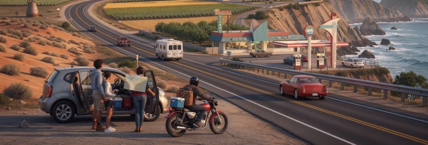
Gas station design heritage from art deco to googie architecture
Gas stations, perhaps the most ubiquitous structures along California’s highways, have evolved from simple fuel depots into minor architectural events in their own right. In the 1920s and 1930s, many service stations adopted Art Deco and Spanish Revival motifs to harmonise with nearby downtowns and residential districts. Stucco walls, tile roofs, and decorative towers helped reassure early motorists that they were patronising reputable establishments rather than improvised roadside sheds. These designs also reflected oil companies’ desire to project stability and modernity as they expanded into the far reaches of the state.
By the 1950s and 1960s, as traffic volumes soared on new freeways, gas station architecture embraced Googie style—a futuristic, space-age aesthetic born in Southern California coffee shops. Dramatic cantilevered canopies, upswept rooflines, and neon boomerangs made it easy for speeding drivers to spot fuel stops from a distance. Some of these expressive stations still stand near older freeway exits in Los Angeles, Orange County, and the Bay Area, though many have been remodelled with more subdued corporate branding. Spotting an intact Googie canopy on a road trip is a bit like birdwatching; once you know what to look for, you see how these structures enliven otherwise generic commercial strips.
Today, as electric vehicle charging stations begin to appear at highway rest stops and shopping centres, we’re witnessing the next chapter in roadside design. While many current chargers are simple, utilitarian installations, some developers are experimenting with solar canopies, landscaped rest areas, and integrated cafés, echoing earlier eras when fuel stops doubled as social hubs. The question for the coming decades is whether EV infrastructure will foster its own distinctive architectural language, just as Art Deco and Googie did in their time—or whether energy provision will fade more quietly into the built environment.
Roadside giant sculptures and california’s quirky highway landmarks
From towering doughnuts atop bakeries to oversized dinosaurs guarding desert exits, California’s highways are dotted with giant sculptures that function as both advertisements and folk art. These “roadside giants” emerged in the mid-20th century as businesses competed for drivers’ attention at 55 miles per hour, discovering that a 20-foot-tall Paul Bunyan or concrete brontosaurus was hard to ignore. Along routes such as Interstate 10 near Cabazon, Highway 101 through the Central Coast, and smaller coastal roads in the north, these outsized figures still loom over parking lots and ridgelines.
While some of these landmarks began as kitschy marketing ploys, they’ve often been embraced by communities and travellers as beloved icons. Families plan photo stops at the Cabazon Dinosaurs, surfers use giant doughnut signs as meeting points, and vintage postcards immortalise lumberjacks and cowboys that once beckoned motorists into themed restaurants or gift shops. Over time, as original businesses close or change hands, the sculptures sometimes outlive their commercial purpose and become free-standing wayfinding markers in the cultural landscape.
For the modern road tripper, tracking down these quirky installations can add a scavenger-hunt element to long drives. They also invite reflection on how marketing, memory, and place-making intersect along the highway. What other form of advertising inspires people to pull over, pose for photos, and share images decades after the original product or service has disappeared?
Environmental impact and sustainable highway tourism practices
California’s highways offer unparalleled access to beaches, deserts, forests, and mountains—but that very accessibility comes with environmental costs. Vehicle emissions contribute to air quality challenges in basins such as Los Angeles and the San Joaquin Valley, while the physical footprint of roads fragments wildlife habitat and alters natural drainage patterns. Popular scenic routes like Highway 1 through Big Sur or the approaches to national parks can experience intense seasonal congestion, leading to roadside erosion, litter, and strain on small communities’ waste and water systems.
In response, state agencies and local stakeholders have begun implementing more sustainable highway tourism practices. Shuttle systems now operate in peak seasons for destinations like Yosemite Valley and some coastal state parks, reducing the number of private vehicles in the most sensitive areas. Carpool incentives, high-occupancy vehicle (HOV) lanes, and growing networks of electric vehicle chargers along corridors such as Interstate 5 and Highway 99 encourage lower-emission travel. For individual travellers, choosing fuel-efficient or electric vehicles, combining multiple stops into a single loop, and travelling in the shoulder seasons can significantly reduce both personal carbon footprints and pressure on popular sites.
Highway design itself is also evolving with ecological considerations in mind. Wildlife crossings—overpasses and underpasses designed specifically for animals—have been constructed or proposed along segments of Highway 101, Interstate 15, and other major routes, helping to reconnect fragmented habitats. Native-plant landscaping in medians and at interchanges reduces water use and provides pollinator habitat, while improved stormwater systems filter runoff before it reaches rivers and coastal waters. As you drive, you may not always see these interventions, but they represent a quiet shift toward treating highways less as impermeable scars and more as carefully managed interfaces between human movement and natural systems.
For travellers who want to engage more directly with sustainable highway culture, there are practical steps you can take. Seek out locally owned lodgings and restaurants within walking distance of your overnight stop, so you can park once and explore on foot. Pack reusable water bottles and coffee cups to minimise single-use plastics picked up at gas stations and convenience stores. And perhaps most importantly, respect posted closures and parking restrictions in fragile areas; when a landslide-prone section of Big Sur or a dune ecosystem near Pismo Beach is off-limits, it’s not an inconvenience so much as a necessary pause to allow landscapes to recover.
Digital age navigation technology and modern highway travel patterns
The advent of GPS, smartphone navigation apps, and real-time traffic data has transformed how we experience California’s highways as profoundly as any new bridge or tunnel. For earlier generations, paper maps, folded atlases, and hand-written directions from motel clerks shaped route choices and fuel stops. Today, apps like Google Maps, Apple Maps, and Waze dynamically reroute drivers around congestion, surface accidents within seconds, and even suggest rest stops and attractions based on user reviews. This digital layer effectively overlays a second, invisible highway network on the physical one, influencing where we stop, what we see, and how we perceive distance.
One of the most significant changes is the rise of algorithmically suggested “shortcuts” through residential streets and rural backroads, which can divert unexpected waves of traffic into neighbourhoods never designed for through-commuters. In scenic areas, geotagged social media posts can turn once-quiet pullouts into viral “must-see” locations, concentrating crowds and parking issues in spots that lack basic infrastructure. At the same time, digital tools make it easier than ever for road trippers to discover lesser-known state parks, historic sites, and local businesses just off the main arteries—if they choose to look beyond the fastest-route default.
For many travellers, in-car connectivity and driver-assistance technologies are reshaping the very feel of long-distance driving. Adaptive cruise control, lane-keeping assist, and increasingly automated systems reduce fatigue on monotonous stretches like Interstate 5, while podcasts, audiobooks, and streaming music let you curate a personalised soundscape for your journey. Yet there’s a trade-off: when an app narrates every lane change and exit in advance, the sense of serendipity that once came from missing a turn and discovering a new town can be diminished.
Finding a balance may be the modern highway traveller’s central challenge. We can use digital tools to stay safer—checking road-closure updates after a storm along Highway 1, for instance, or locating the nearest fast charger in the Central Valley—while still allowing space for unplanned detours and analogue engagement. Turning off turn-by-turn directions on a scenic byway, using your phone as a backup rather than a constant guide, or consulting a traditional map to understand the broader geography can all help restore a sense of exploration. In this way, the culture of the California highway continues to evolve, integrating new technologies while retaining the timeless appeal of pointing your vehicle toward the horizon and seeing where the road leads.


