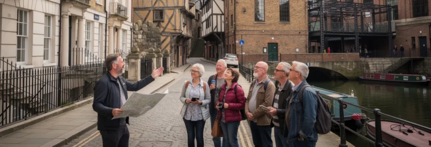
Historic neighborhoods hold layers of stories waiting to be discovered beneath their modern facades. From Georgian townhouses to medieval timber-framed buildings, these districts preserve architectural treasures and human narratives that span centuries. Walking tours offer an immersive approach to understanding urban heritage, revealing details that remain invisible to casual passersby. Every cobblestone, every weathered doorway, and every hidden courtyard contributes to a complex tapestry of social, economic, and architectural evolution that shaped Britain’s most fascinating urban landscapes.
The experience of exploring historic quarters on foot transforms abstract historical knowledge into tangible encounters with the past. Professional guides trained in architectural history, archaeology, and local heritage interpretation provide context that brings these neighborhoods to life. Unlike traditional museum visits, walking tours position you directly within the historical environment, allowing you to appreciate spatial relationships, urban planning principles, and the physical materiality of historic structures. This approach creates memorable learning experiences that resonate far beyond conventional educational methods.
Architectural heritage trails through georgian london’s bloomsbury and fitzrovia districts
Bloomsbury and Fitzrovia represent some of London’s most architecturally coherent Georgian developments, where 18th and early 19th-century planning principles created unified residential squares and terraces. These districts showcase the evolution of upper-middle-class urban living during a period of unprecedented expansion in the capital. Walking through these neighborhoods reveals sophisticated design approaches that balanced private comfort with public grandeur, establishing patterns that influenced British urban development for generations.
Uncovering the brunswick square development and thomas cubitt’s construction techniques
Brunswick Square demonstrates the innovative building methods pioneered by Thomas Cubitt, who revolutionized London construction in the early 19th century. Cubitt’s approach integrated all building trades under direct employment, ensuring quality control and efficiency previously unknown in speculative development. His techniques employed standardized components, improved drainage systems, and robust structural frameworks that explain why these buildings remain structurally sound nearly two centuries later. Examining the Brunswick Square terraces reveals details like the use of Suffolk white bricks for facades and London stock bricks for structural walls, demonstrating material hierarchies that balanced aesthetics with economy.
The british museum quarter’s hidden mews and victorian servants’ passages
Behind the grand facades surrounding the British Museum, a network of service infrastructure supported Georgian household operations. Mews lanes originally accommodated horses and carriages, with upper floors housing grooms and stable staff. These narrow passages reveal the spatial segregation fundamental to Georgian social organization, where servants moved through separate circulation systems to maintain the illusion of effortless domestic management. Walking tours through areas like Montague Mews expose architectural features like mounting blocks, coal holes, and servants’ entrances that illuminate the practical realities beneath polished period aesthetics.
Senate house art deco facades and charles holden’s brutalist influence
Senate House towers above Bloomsbury as an architectural transition point between Art Deco elegance and emerging Brutalist principles. Charles Holden designed this University of London administrative building in the 1930s, employing Portland stone cladding over a steel frame structure. The building’s massing, setbacks, and vertical emphasis demonstrate Holden’s mastery of monumental architecture while prefiguring post-war Brutalism. Details like the bronze window frames, geometric ornamentation, and carefully proportioned tower demonstrate how Modernist architects adapted classical proportioning systems to contemporary materials and construction methods. Senate House’s controversial wartime role adds another layer of historical significance that walking tours often explore.
Fitzroy square’s robert adam terraces and portland stone preservation methods
Fitzroy Square showcases Robert Adam’s neoclassical design principles applied to speculative housing development in the 1790s. The eastern and southern terraces display Adam’s characteristic refined detailing, with delicate stucco ornament and carefully balanced proportions creating unified compositions from individual townhouses. Modern preservation challenges include managing Portland stone decay, where atmospheric pollution and moisture penetration threaten structural integrity. Conservation walking tours examine techniques like lime mortar repointing and micro-crystalline wax consolidation that extend the lifespan of historic masonry. Understanding
methods like these helps you appreciate why apparently fragile façades continue to withstand London’s pollution, vibration from traffic, and even nearby construction activity. As you walk around Fitzroy Square, guides often encourage you to look closely at tell-tale signs of conservation work—subtly different mortar colours, tiny stainless-steel anchors, or discreet stone indents—that reveal the ongoing dialogue between past fabric and present-day preservation.
Medieval quarter walking routes in york’s shambles and stonegate conservation areas
York’s Shambles and Stonegate conservation areas offer some of the most atmospheric medieval walking tours in Britain. Here, the urban fabric still follows patterns established in the Middle Ages, with narrow lanes, overhanging upper storeys, and irregular plot boundaries shaped by centuries of incremental building. Exploring these historic neighborhoods on foot allows you to see how commerce, religion, and daily life intertwined in a compact walled city. While modern shopfronts occupy the ground floors, the upper levels preserve timber frames, mullioned windows, and rooflines that have changed little since the 15th century.
Timber-framed jettied buildings and 14th-century butchers’ architecture
The Shambles is internationally famous for its timber-framed jettied buildings, whose upper floors project over the street. This seemingly picturesque feature was originally a pragmatic response to narrow medieval plots and high property values: by extending each upper storey slightly, builders increased floor space without widening the ground footprint. On many walking tours, guides point out the chamfered jetty brackets and exposed tie beams that reveal the carpentry logic behind these structures. The result is a canyon-like street, where opposing eaves almost meet overhead, creating a sense of enclosure that you rarely experience in modern city planning.
Historically, the Shambles was dominated by butchers’ shops, and its medieval butchers’ architecture still shapes the streetscape. Look for the wide window openings at chest height, once used to display meat, and the deep stone slabs that formed counters and working surfaces. Many drainage channels, or shambles gutters, survive along the street edges, designed to carry away blood and waste. When you stand here on a guided tour, it is easy to imagine the noise, smell, and bustle of 14th-century trade, turning the idyllic-looking lane into a highly functional—and often unsanitary—industrial environment.
Snickelways navigation: lady peckett’s yard and coffee yard medieval alleyways
York’s famous “Snickelways” are narrow pedestrian passages that thread between and behind main streets, offering a labyrinthine route through the medieval core. Names like Lady Peckett’s Yard and Coffee Yard encapsulate layers of local history, hinting at former property owners, trades, and social spaces. For visitors, navigating these Snickelways on a walking tour is like peeling back the surface of the city to reveal the service routes and shortcuts used by medieval residents. The tight angles, sudden turns, and unexpected courtyards contrast sharply with the straight lines of Georgian and Victorian planning.
Lady Peckett’s Yard, for example, connects Low Petergate with Fossgate through a sequence of irregular courtyards framed by timber-framed and brick buildings. Coffee Yard, meanwhile, gives access to the restored Barley Hall, a reconstructed medieval townhouse that illustrates elite domestic life. Guides often use these alleyways to explain how property boundaries, right-of-way agreements, and informal paths produced a three-dimensional urban network. For today’s urban explorers, following Snickelways is both a practical navigation strategy and an immersive way to experience York’s hidden medieval topography.
Roman foundations beneath king’s square and multangular tower remnants
Beneath York’s medieval streets lie the remains of Eboracum, the Roman fortress and settlement that founded the city’s urban history. King’s Square, now a lively public space at the junction of several shopping streets, sits close to the line of the Roman fortress wall. Archaeological investigations have revealed Roman road surfaces, drainage systems, and building foundations under the surrounding plots. On specialist walking tours, guides often carry excavation photographs or plans to help you visualize how today’s street pattern overlays the original Roman grid.
A short walk away, within the Museum Gardens, the Multangular Tower preserves one of the most visible stretches of Roman military engineering in northern England. Its lower courses, built in characteristic Roman gritstone and tile bonding, support later medieval additions of magnesian limestone. When you stand alongside the tower, your guide may invite you to compare the Roman and medieval masonry techniques, much like reading two chapters of the same story written in different architectural “handwriting.” This layered structure provides a tangible reminder that historic neighborhoods often rest on foundations far older than their visible buildings suggest.
Guild hall merchant networks and medieval trade route archaeology
York’s medieval prosperity depended on powerful merchant guilds that organized trade, regulated quality, and funded civic building projects. The Guildhall, located near the River Ouse, was a central venue for these activities, hosting meetings, feasts, and legal proceedings. Walking tours that focus on economic history often trace routes from the riverside wharves, where goods arrived by boat, to the Guildhall and surrounding streets that once housed mercers, goldsmiths, and cloth traders. By following these paths, you can reconstruct the commercial geography that underpinned York’s wealth.
Archaeological investigations along these medieval trade routes have uncovered imported ceramics, metalwork, and organic remains that testify to York’s connections with continental Europe and the Baltic. Guides may reference specific finds—Hanseatic pottery, for example—to illustrate how this inland city functioned as a node in international networks. For modern visitors interested in historic walking tours, these details turn apparently modest alleys and quaysides into critical clues in a larger story about medieval globalization and merchant power.
Industrial revolution heritage trails through manchester’s northern quarter and ancoats
Manchester’s Northern Quarter and Ancoats neighborhoods are often described as the world’s first industrial suburb, where textile manufacturing, engineering, and transport infrastructure grew in tandem. Today, walking tours through these districts reveal a dense concentration of 19th-century warehouses, mills, and workers’ housing, many repurposed for 21st-century creative industries. Exploring on foot helps you understand how the Industrial Revolution reshaped urban form, creating new building types, street hierarchies, and social geographies. You can still trace the proximity between production sites, transport routes, and working-class communities that defined industrial city life.
Cotton mill warehouses: brownsfield and murray’s mills adaptive reuse
Brownsfield Mill and Murray’s Mills in Ancoats offer textbook examples of early industrial architecture and its contemporary adaptive reuse. Originally built to house mechanized cotton spinning, these mills were constructed with robust brick walls, cast-iron columns, and fireproof vaulted floors—innovations designed to accommodate heavy machinery and reduce the risk of catastrophic fires. On guided heritage trails, you’ll often be invited to count window bays, examine loading doors, and notice external hoist beams that once lifted raw materials and finished goods between floors. These physical details make it easier to imagine the mills as noisy, crowded workplaces rather than quiet residential blocks.
In recent decades, both Brownsfield and Murray’s Mills have undergone careful conversion into apartments, offices, and cultural spaces. Successful adaptive reuse projects must balance modern building regulations—fire safety, insulation, accessibility—with the preservation of historic fabric. This can mean threading new services through existing structural grids or inserting contemporary glass elements into old brick shells. For anyone interested in how cities evolve, walking through these redeveloped complexes is like seeing a palimpsest, where each layer of use leaves traces without entirely erasing the previous one.
Victorian canal system navigation and rochdale canal engineering
The Rochdale Canal and its connecting waterways formed a critical transport network for industrial Manchester, moving raw cotton, coal, and manufactured goods long before railways dominated heavy freight. A canal-side walking tour turns what might appear to be a pleasant waterside stroll into a lesson in Victorian engineering and logistics. You’ll encounter lock flights, towpaths, and bascule or swing bridges, each element optimized to maintain water levels and accommodate fluctuating traffic. Guides often highlight the precise stonework of lock chambers and the ironwork of original balance beams as evidence of the craftsmanship invested in utilitarian infrastructure.
Understanding canal engineering also changes how you read the surrounding industrial landscape. Warehouses line the water’s edge with large arched openings at towpath level, where boats could be loaded directly from storage floors above. In some places, you can still see warehouse hoist doors and winch housings preserved in situ. By following the canal through the Northern Quarter and Ancoats, you trace the spine along which the industrial neighborhood grew, revealing how water transport dictated building orientation, street crossings, and even the location of pubs and lodging houses that catered to boatmen.
Workers’ housing typologies in little italy and terraced street patterns
Just a short distance from the mills, dense rows of terraced housing illustrate how industrial expansion shaped everyday living conditions. In Ancoats’ “Little Italy” area, 19th-century migration from Italian regions created a distinctive cultural enclave within a broader working-class district. Terraces here, like elsewhere in Manchester, typically followed a regular pattern: narrow frontages, back-to-back or through houses, and small yards opening onto service alleys. On a walking tour, guides may ask you to compare these modest dwellings with the scale of nearby factories, emphasizing the physical proximity between work and home that defined industrial urbanism.
Examining workers’ housing typologies reveals subtle but telling variations in status and planning. Presence or absence of front gardens, the width of doorways, and the detailing of window surrounds all hint at different target occupants, from skilled engineers to unskilled laborers. Conservation-focused tours often discuss how modern regeneration projects have upgraded these houses—introducing insulation, modern services, and improved public spaces—while trying to retain street patterns and characteristic brick façades. For visitors, walking these streets is an opportunity to think about social history in three dimensions: how people slept, cooked, socialized, and navigated daily life in one of the world’s first industrial cities.
Victorian maritime quarter explorations in liverpool’s albert dock and ropewalks
Liverpool’s Albert Dock and Ropewalks districts preserve the architectural legacy of Britain’s 19th-century maritime power. Here, waterfront warehouses, dock basins, and narrow rope-making streets tell stories of global trade, migration, and industrial innovation. Walking tours through these historic neighborhoods often intertwine architectural observation with discussions of economic history and social justice, from the transatlantic cotton trade to the complex legacies of slavery. For anyone interested in how ports shaped urban form, Liverpool offers one of the most instructive open-air case studies in the country.
Jesse hartley’s hydraulic engineering and cast-iron dock infrastructure
Albert Dock, opened in 1846 and designed by dock engineer Jesse Hartley, revolutionized dock construction with its use of cast iron, brick, and granite instead of combustible timber. The warehouses form a continuous perimeter around a central water basin, allowing ships to load and unload directly into secure, fire-resistant storage. On a walking tour, your guide might invite you to run your hand along the massive granite columns or peer up at the cast-iron beams, drawing attention to how industrial aesthetics can also be monumental and elegant. Hartley’s dock system integrated hydraulic cranes and gates, enabling efficient cargo handling that kept pace with expanding trade volumes.
Many of these hydraulic features have long since been decommissioned, but traces remain in the form of capstans, crane bases, and culverted channels. Understanding how water levels, tidal movements, and dock gates were managed helps visitors appreciate the technical sophistication behind what might otherwise appear as simple brick sheds around a pool. For today’s maritime heritage trails, interpreting this infrastructure is crucial: it transforms Albert Dock from a picturesque leisure destination into a working machine whose preserved components still speak of Victorian engineering prowess.
Baltic triangle warehouse conversions and shipping merchants’ offices
Just inland from the waterfront, the Baltic Triangle and adjacent Ropewalks area showcase another facet of Liverpool’s maritime history: warehouses, workshops, and merchants’ offices tied to shipping and trading firms. Many of these buildings date from the late 19th and early 20th centuries, featuring robust brick construction, large loading doors, and internal hoist systems. As in Manchester, adaptive reuse has reshaped the district into a hub for creative industries, nightlife, and digital businesses. Walking tours that focus on urban regeneration use the Baltic Triangle as a live laboratory for discussing how historic neighborhoods can be repurposed without losing their character.
Shipping merchants’ offices, with their ornate façades, timber-panelled interiors, and clerical counting houses, illustrate the administrative side of maritime commerce. Guides may invite you to contrast these relatively refined spaces with the hard-wearing warehouses nearby, emphasizing how knowledge work and physical labor occupied different but closely linked environments. For visitors, understanding this relationship is key to seeing the area not just as a collection of attractive brick buildings, but as an integrated ecosystem that once connected distant oceans with Liverpool’s streets.
Underground williamson tunnels and georgian quarry networks
Beneath parts of Liverpool’s Georgian and Victorian districts lies a mysterious network of tunnels associated with philanthropist and businessman Joseph Williamson. These underground spaces, some carved into sandstone and others constructed with brick vaulting, have sparked decades of speculation about their original purpose—ranging from philanthropic employment schemes to storage or even private eccentricity. On specialist walking tours, surface routes around the Edge Hill area are often combined with guided descents into accessible sections of the tunnels, creating a dramatic contrast between the ordered Georgian streets above and the labyrinth below.
The Williamson Tunnels intersect with earlier quarry workings that provided building stone for Liverpool’s rapid expansion. Archeological investigation of these subterranean spaces has uncovered domestic artifacts, construction debris, and structural clues that help researchers reconstruct phases of tunneling and backfilling. For heritage trail participants, visiting or even just walking above these hidden voids reinforces a broader lesson: historic neighborhoods are rarely just what you can see at street level. Layers of infrastructure, extraction, and experimentation often lie beneath your feet, shaping the surface city in subtle but profound ways.
Edinburgh old town closes and wynds: underground street archaeological tours
Edinburgh’s Old Town, strung along the Royal Mile from the Castle to Holyrood, preserves a vertical city of towering tenements, steep alleys, and hidden courtyards. Walking tours here often feel theatrical, leading you through narrow closes and wynds that suddenly open onto sweeping vistas or enclosed squares. Yet some of the most intriguing routes descend below current street level, where sections of earlier streets and buildings have been sealed off, built over, or incorporated into later structures. These underground tours turn urban archaeology into a lived experience, inviting you to step into spaces that once lay in the open air.
Mary king’s close plague history and 17th-century tenement foundations
Mary King’s Close is perhaps the best-known example of Edinburgh’s buried streetscape, partially preserved beneath the buildings around the Royal Mile. Once a bustling residential close, it was progressively enclosed and built over during the 18th and 19th centuries, leaving sections of its tenements and alleyways intact below ground. Guided tours lead visitors along these dimly lit passages, using archival records and archaeological evidence to reconstruct daily life in the 17th century. You can see original stone thresholds, remnants of timber floors, and the foundations of tall tenements that once towered several storeys above.
The site’s association with plague outbreaks has attracted particular attention, and today’s interpretive tours balance macabre curiosity with evidence-based history. Rather than repeating sensational myths, professional guides explain how cramped living conditions, poor sanitation, and limited medical knowledge contributed to disease transmission. For those interested in walking tours that explore the “dark side” of historic neighborhoods, Mary King’s Close offers a powerful reminder that picturesque architecture often coexisted with harsh social realities.
Royal mile underground vaults and south bridge chamber systems
Further along the Old Town, a network of underground vaults beneath the South Bridge and adjacent streets adds another layer to Edinburgh’s subterranean heritage. Originally constructed in the late 18th century as storage and workshop spaces within the bridge’s arches, these vaulted chambers quickly fell into disuse and disrepair. Over time, they became associated with illicit activities, overcrowded lodging, and urban poverty. On contemporary walking tours, access to selected vaults allows you to experience the distinctive acoustics, humidity, and darkness of these spaces while learning about the people who lived and worked here.
The vaults also illustrate how engineering and social history intersect. South Bridge was designed to connect the Old Town ridge with expanding districts to the south, but the creation of enclosed vaults as a by-product of structural design unintentionally produced new kinds of urban space. For visitors, understanding this process is a bit like learning how the “backstage” areas of a theatre operate: once you see how functional voids are created within infrastructure, you start to notice similar patterns in viaducts, undercrofts, and basement networks in other historic neighborhoods.
Flodden wall defensive architecture and medieval city boundary traces
Long before bridges and vaults reshaped Edinburgh’s topography, the city’s form was constrained by its defensive perimeter: the Flodden Wall. Built in the early 16th century after the Battle of Flodden, this stone fortification encircled much of the Old Town, controlling access and symbolizing civic identity. Today, only fragments of the wall survive, tucked behind modern developments or incorporated into later buildings. Walking tours that focus on the city’s military and political history often trace the line of the wall, inviting participants to imagine how gates, towers, and ditches defined the medieval urban boundary.
Following the course of the Flodden Wall on foot reveals how defensive needs shaped street alignments and property boundaries that persist to this day. In some locations, you can see blocked postern gates, reused masonry, or changes in stonework marking the transition from free-standing wall to party wall. For those interested in urban morphology, these subtle clues are invaluable: they show how even partial archaeological remains can be read to reconstruct the geometry of lost fortifications and understand how cities negotiated the tension between security and expansion.
John knox house reformation period interiors and netherbow port remains
Near the former site of the Netherbow Port—once the main gate between Edinburgh’s Old Town and Canongate—stands John Knox House, a surviving example of a late medieval and early modern townhouse. Although its exact association with the Reformation preacher John Knox is debated, the building’s interiors provide rare insight into domestic life during a period of intense religious and political upheaval. Guided tours typically lead visitors through timber-panelled rooms, projecting oriel windows, and intricately carved details, using these features to discuss status, privacy, and devotional practice in 16th-century Edinburgh.
The area around John Knox House also preserves traces of the Netherbow Port, demolished in the 18th century to improve traffic flow. Stone markers in the street and surviving fragments of masonry in nearby buildings indicate where this fortified gate once stood, controlling movement along the Royal Mile. When you stand here on a walking tour, you are positioned at a former threshold between jurisdictions—city and burgh, Old Town and Canongate. Understanding this historic division helps explain patterns of church location, market regulation, and civic ceremony that still influence the character of the surrounding neighborhoods.
Bath’s palladian architecture circuit: circus, royal crescent and thermal spring sites
Bath’s historic center offers one of the most coherent ensembles of Georgian Palladian architecture in Europe, organized around a unique relationship with the city’s ancient thermal springs. Walking circuits that link the Circus, the Royal Crescent, and the Roman Baths allow you to trace how classical design principles, speculative development, and spa culture combined to produce a distinctive urban landscape. Unlike more piecemeal historic neighborhoods, Bath’s 18th-century developments were conceived on a grand scale, with unified façades and carefully choreographed vistas that are best appreciated on foot.
John wood the elder’s mathematical urban planning and geometric street layouts
Architect and planner John Wood the Elder played a pivotal role in shaping Bath’s Palladian identity, drawing on classical precedents and mathematical proportion to design new residential quarters. The Circus, completed by his son but conceived by Wood, is a circular arrangement of townhouses whose curvature and rhythmic column orders produce a sense of architectural theatre. On a walking tour, guides often encourage visitors to stand at the center and slowly rotate, observing how repeating window bays and cornice lines create a continuous yet subtly varied façade. It’s an experience that simply doesn’t translate from photographs or maps.
Wood’s planning didn’t stop at individual buildings; he laid out geometric street patterns—crescents, circuses, and axial connections—that orchestrated movement and views across the hillside site. Understanding these layouts can feel a bit like learning the rules of a board game: once you grasp the underlying geometry, the apparent complexity of Bath’s terraces resolves into a clear, legible system. For those interested in historic walking routes, following these planned axes between squares and crescents reveals how 18th-century designers used space to shape social interactions and display wealth.
Roman baths hypocaust systems and sacred spring archaeological evidence
At the heart of Bath’s historic neighborhood lies the thermal spring that first attracted Roman settlers and continues to define the city’s identity. The Roman Baths complex, partially excavated and presented at modern street-below level, allows visitors to see sophisticated hypocaust heating systems, lead-lined pools, and temple remains associated with the goddess Sulis Minerva. Although this is a ticketed site rather than an open street, many walking tours integrate it conceptually, using surrounding vantage points to explain how later buildings layered over the Roman core.
Archaeological evidence from the Baths—inscribed curse tablets, sculptural fragments, and water management structures—reveals a complex of religious, social, and therapeutic functions. Guides often draw analogies between the Roman baths and a modern wellness center combined with a civic club, helping contemporary visitors grasp how central the complex was to urban life. When you emerge back onto the surrounding streets, you carry a new awareness that much of Georgian Bath’s planned elegance literally sits above and around an older sacred landscape, demonstrating how historic neighborhoods can embody millennia of continuous use.
Georgian townhouse interior design: assembly rooms and pump room decoration
While Bath’s terraces impress from the outside, understanding Georgian townhouse interiors completes the picture of 18th-century elite life. Public spaces such as the Assembly Rooms and the Pump Room provide accessible examples of period interior design, from delicate plasterwork ceilings to patterned wooden floors and carefully proportioned doorways. On architectural walking tours, these interiors are often used as case studies for discussing how ideas about comfort, sociability, and status were expressed through spatial arrangement and decoration. You might notice how circulation routes separate servants’ access from formal reception rooms, echoing patterns seen in London’s Bloomsbury.
Decoration in these spaces followed fashionable neoclassical motifs—swags, urns, and pilasters—executed in plaster, paint, and gilding. Yet behind the grace and symmetry lay practical considerations about heating, lighting, and acoustics, all of which guides may highlight. For visitors interested in historic neighborhoods, seeing both façades and interiors in Bath underlines an important point: architectural heritage is not just about street elevations, but about how rooms were used, furnished, and experienced from within. Walking between the Circus, Royal Crescent, Assembly Rooms, and Pump Room creates a continuous narrative linking urban form, social ritual, and interior design into a single, richly textured story of place.


